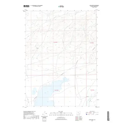
2017 Map of Ayres Spring
USGS Topo · Published 2017About this map
Post Lake and the winding course of the Laramie River anchor the southern reaches of this high plains landscape in Albany County. The terrain is defined by a network of drainage systems, including Sevenmile Cr and Spring Cr, which cut through the high country surrounding Red Hill. Vital water sources for local ranching and wildlife are documented at Ayres Spring and Box Spring. Sparse but essential infrastructure connects this remote area, primarily via Palmer Canyon Rd and Kite Ranch Rd. The map illustrates a traditional Western landscape where water dictates the location of landmarks and travel routes, preserving the spatial relationship between the river valley and the arid uplands of the Laramie Range foothills.
Find a feature on this map
16 named features on this map. Tap any name to fly to it.
Don’t see what you’re looking for? This feature index may not catch every label — zoom into the map to look around manually.
Map Details
Editions of this 2017 Ayres Spring Map
This is the sole edition of this map. No revisions or reprints were ever made.
Other maps of this area

1954 · Torrington
USGS Topo · 1:250,000

1954 · Cheyenne
USGS Topo · 1:250,000

1955 · Mc Gill Lakes
USGS Topo · 1:24,000

1955 · Dodge Ranch
USGS Topo · 1:24,000

1955 · Bluegrass Wells
USGS Topo · 1:24,000

1955 · Sevenmile Spring
USGS Topo · 1:24,000

1955 · Ayres Spring
USGS Topo · 1:24,000

1955 · Cannonball Cut
USGS Topo · 1:24,000

1958 · Cheyenne
USGS Topo · 1:250,000

1958 · Torrington
USGS Topo · 1:250,000