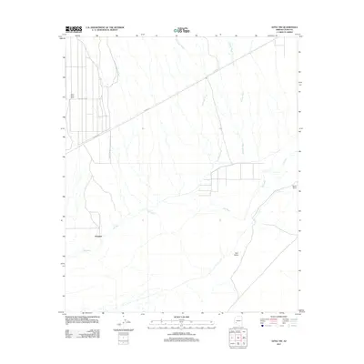
2011 Map of Aztec NW
USGS Topo · Published 2011About this map
The Gila River meanders through this arid landscape in Yuma County, providing a stark hydrological contrast to the surrounding desert plains and seasonal drainages. During this period, the area is defined by its agricultural pockets and transit corridors, most notably the White Wing Ranch and the small settlement of Palomas. The terrain is shaped by broad alluvial features like Red Raven Wash and Clanton Wash, which cut through the flatlands toward the river valley. To the east, the prominent rise of Sears Point overlooks the river's path, serving as a significant geographical landmark. Human activity is largely organized around irrigation and regional transport, with roads such as Palomas Harquahala Rd and W Dateland Rd connecting these isolated outposts. To the south, Park Valley sits near the river bend, highlighting the community's historical reliance on the valley's water resources in an otherwise harsh environment.
Find a feature on this map
11 named features on this map. Tap any name to fly to it.
Don’t see what you’re looking for? This feature index may not catch every label — zoom into the map to look around manually.
Map Details
Editions of this 2011 Aztec NW Map
This is the sole edition of this map. No revisions or reprints were ever made.
Other maps of this area

1927 · Hyder
USGS Topo · 1:62,500

1929 · Aztec
USGS Topo · 1:62,500

1930 · Stoval
USGS Topo · 1:62,500

1930 · Hyder
USGS Topo · 1:62,500

1942 · Vicksburg
USGS Topo · 1:250,000

1950 · Stoval
USGS Topo · 1:62,500

1950 · Aztec
USGS Topo · 1:62,500

1953 · Ajo
USGS Topo · 1:250,000

1954 · Phoenix
USGS Topo · 1:250,000

1957 · Ajo
USGS Topo · 1:250,000