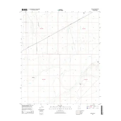
2014 Map of Aztec NW
USGS Topo · Published 2014About this map
Palomas sits in a distinctively arid stretch of the desert where the wide, braided path of the Gila River cuts through the southwestern landscape. The area is defined by its drainage patterns, including the long stretches of Red Raven Wash and Clanton Wash that feed into the river valley. To the north, the terrain transitions into the Hyder Valley, a flat expanse crossed by diagonal corridors like Hyder Rd and Palomas Rd. The map illustrates a sparse but deliberate human footprint, with localized settlements like Park Valley and ranching infrastructure such as E Dateland Ranch Rd. Notable geographical features such as The Lagoon and the high ground of Sears Point provide clear landmarks in this desert environment, marking the convergence of critical water sources and transportation routes in Yuma County.
Find a feature on this map
18 named features on this map. Tap any name to fly to it.
Don’t see what you’re looking for? This feature index may not catch every label — zoom into the map to look around manually.
Map Details
Editions of this 2014 Aztec NW Map
This is the sole edition of this map. No revisions or reprints were ever made.
Other maps of this area

1927 · Hyder
USGS Topo · 1:62,500

1929 · Aztec
USGS Topo · 1:62,500

1930 · Stoval
USGS Topo · 1:62,500

1930 · Hyder
USGS Topo · 1:62,500

1942 · Vicksburg
USGS Topo · 1:250,000

1950 · Stoval
USGS Topo · 1:62,500

1950 · Aztec
USGS Topo · 1:62,500

1953 · Ajo
USGS Topo · 1:250,000

1954 · Phoenix
USGS Topo · 1:250,000

1957 · Ajo
USGS Topo · 1:250,000