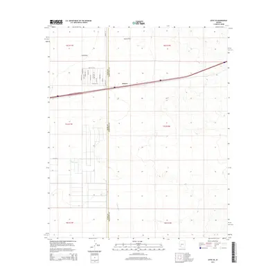
2014 Map of Aztec SE
USGS Topo · Published 2014About this map
Stanwix sits along the interstate corridor in this desert landscape straddling the Yuma County and Maricopa County border. The settlement pattern in Park Valley reveals a unique grid of street names themed after nuts and trees, including Brazil Nut Way, Pecan Way, and Cashew Way. This agricultural or planned development character contrasts with the surrounding arid geography, where the Tenmile Wash winds southward through the terrain. The topography is largely defined by the Stanwix Flats, an expanse that transition towards more varied elevation in the eastern sections of the quadrangle. These named roadways and distinct county boundaries provide clear markers for researchers tracking the modern evolution of this rural Arizona corridor.
Find a feature on this map
21 named features on this map. Tap any name to fly to it.
Don’t see what you’re looking for? This feature index may not catch every label — zoom into the map to look around manually.
Map Details
Editions of this 2014 Aztec SE Map
This is the sole edition of this map. No revisions or reprints were ever made.
Other maps of this area

1927 · Aguila Mountains
USGS Topo · 1:48,000

1929 · Aztec
USGS Topo · 1:62,500

1930 · Aguila Mountains
USGS Topo · 1:62,500

1949 · Sentinel
USGS Topo · 1:62,500

1950 · Sentinel
USGS Topo · 1:62,500

1950 · Aztec
USGS Topo · 1:62,500

1953 · Ajo
USGS Topo · 1:250,000

1957 · Ajo
USGS Topo · 1:250,000

1958 · Ajo
USGS Topo · 1:250,000

1962 · Ajo
USGS Topo · 1:250,000