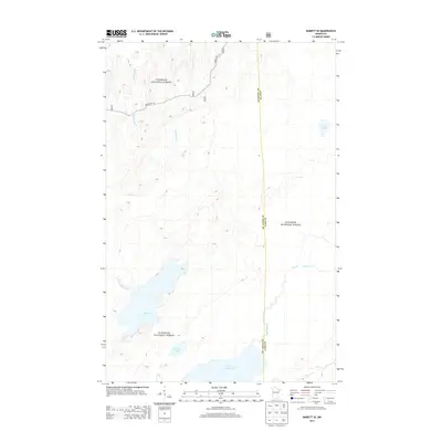
2013 Map of Babbitt SE
USGS Topo · Published 2013About this map
Superior National Forest defines the character of this northeastern Minnesota landscape, where a dense network of water bodies and marshy lowlands dominates the terrain. The hydrology of the region is anchored by Seven Beaver Lake and the nearby Big Lake, with a complex system of drainage including the Dunka River, North River, and East River. The map illustrates the sparsely populated wilderness of the Arrowhead region, showing the boundary between St. Louis Co and Lake Co as it runs north-to-south through these wetlands. Access to this remote interior is limited to designated forest roads, specifically Forest Rte 114 and Forest Rte 116, which provide the primary terrestrial routes through the forest's boggy expanse.
Find a feature on this map
14 named features on this map. Tap any name to fly to it.
Don’t see what you’re looking for? This feature index may not catch every label — zoom into the map to look around manually.
Map Details
Editions of this 2013 Babbitt SE Map
This is the sole edition of this map. No revisions or reprints were ever made.
Other maps of this area

1951 · Babbitt SW
USGS Topo · 1:24,000

1951 · Babbitt
USGS Topo · 1:24,000

1952 · Babbitt SE
USGS Topo · 1:24,000

1952 · Babbitt NE
USGS Topo · 1:24,000

1953 · Whyte
USGS Topo · 1:62,500

1954 · Greenwood Lake
USGS Topo · 1:62,500

1954 · Two Harbors
USGS Topo · 1:250,000

1957 · Two Harbors
USGS Topo · 1:250,000

1957 · Brimson
USGS Topo · 1:62,500

1958 · Two Harbors
USGS Topo · 1:250,000