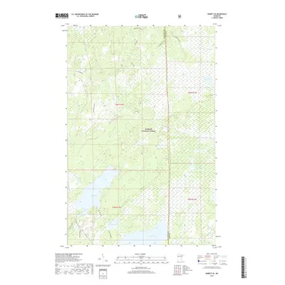
2019 Map of Babbitt SE
USGS Topo · Published 2019About this map
Superior National Forest encompasses this expansive northern Minnesota wetland and river system, where the boundary between St Louis Co and Lake Co runs through a landscape defined by glacial hydrology. The southern portion of the quadrangle is dominated by the sprawling waters of Seven Beaver Lake and the nearby Big Lake, which features the distinctively named Bungalow Bay. These water bodies serve as critical headwaters for the regional drainage network, including the Dunka River and the S Br Partridge River. Movement through this saturated terrain is facilitated by several forest corridors, such as Headwaters Spur and Stone/Big Lake. The map reveals a complex mosaic of marshlands and small basins like Lake Culkin and Swamp Lake, illustrating the preserved wilderness character maintained within the national forest system.
Find a feature on this map
21 named features on this map. Tap any name to fly to it.
Don’t see what you’re looking for? This feature index may not catch every label — zoom into the map to look around manually.
Map Details
Editions of this 2019 Babbitt SE Map
This is the sole edition of this map. No revisions or reprints were ever made.
Other maps of this area

1951 · Babbitt SW
USGS Topo · 1:24,000

1951 · Babbitt
USGS Topo · 1:24,000

1952 · Babbitt SE
USGS Topo · 1:24,000

1952 · Babbitt NE
USGS Topo · 1:24,000

1953 · Whyte
USGS Topo · 1:62,500

1954 · Greenwood Lake
USGS Topo · 1:62,500

1954 · Two Harbors
USGS Topo · 1:250,000

1957 · Two Harbors
USGS Topo · 1:250,000

1957 · Brimson
USGS Topo · 1:62,500

1958 · Two Harbors
USGS Topo · 1:250,000