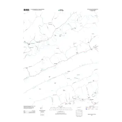
2013 Map of Back Valley
USGS Topo · Published 2013About this map
Thompson Mill stands along the winding Powell River in this Tennessee-Virginia border region, reflecting a landscape defined by its waterways and gaps. The area is characterized by numerous river crossings, including Snodgrass Ford, Fletcher Ford, and Baldwin Ford, which historically linked the communities of Sunnyside and Ramsey. The terrain is marked by distinctive features such as Short Mountain and Chestnut Ridge, which frame the agricultural and residential pockets of Back Valley.
Find a feature on this map
107 named features on this map. Tap any name to fly to it.
Don’t see what you’re looking for? This feature index may not catch every label — zoom into the map to look around manually.
Map Details
Editions of this 2013 Back Valley Map
This is the sole edition of this map. No revisions or reprints were ever made.
Other maps of this area

1883 · Morristown
USGS Topo · 1:125,000

1887 · Jonesville
USGS Topo · 1:125,000

1891 · Jonesville
USGS Topo · 1:125,000

1893 · Morristown
USGS Topo · 1:125,000

1895 · Morristown
USGS Topo · 1:125,000

1932 · Hagan
USGS Topo · 1:62,500
1935 · Ewing
USGS Topo · 1:24,000

1935 · Rogersville
USGS Topo · 1:48,000

1935 · Tate Springs
USGS Topo · 1:48,000

1935 · Lee Valley
USGS Topo · 1:24,000