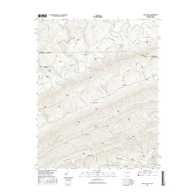
2016 Map of Back Valley
USGS Topo · Published 2016About this map
The Powell River winds through the borderlands of Tennessee and Virginia, carving a deep valley between high ridges like Wallen Ridge and Powell Mtn. This area is defined by a series of narrow hollows and high gaps, such as Gibson Gap and Keaton Gap, which have historically dictated the movement of people and commerce through the mountains. Small settlements like Sunnyside and Evanston sit tucked away from the main river corridor, while the site of Thompson Mill near McDowell Shoal points to the early importance of water power in this rural landscape.
Find a feature on this map
94 named features on this map. Tap any name to fly to it.
Don’t see what you’re looking for? This feature index may not catch every label — zoom into the map to look around manually.
Map Details
Editions of this 2016 Back Valley Map
This is the sole edition of this map. No revisions or reprints were ever made.
Other maps of this area

1883 · Morristown
USGS Topo · 1:125,000

1887 · Jonesville
USGS Topo · 1:125,000

1891 · Jonesville
USGS Topo · 1:125,000

1893 · Morristown
USGS Topo · 1:125,000

1895 · Morristown
USGS Topo · 1:125,000

1932 · Hagan
USGS Topo · 1:62,500
1935 · Ewing
USGS Topo · 1:24,000

1935 · Rogersville
USGS Topo · 1:48,000

1935 · Tate Springs
USGS Topo · 1:48,000

1935 · Lee Valley
USGS Topo · 1:24,000