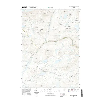
2016 Map of Bad Luck Mountain
USGS Topo · Published 2016About this map
Hudson River and Indian River hydrology dominates this Adirondack landscape, where the confluence and surrounding mountain ridges dictate the settlement patterns of central Hamilton and Essex counties. The isolated Northwoods Club and the Biby Cabin Ridge represent the late-era character of private camps and remote outposts found throughout this region. The terrain is marked by significant peaks such as Bad Luck Mtn and Big Pisgah Mtn, with local landmarks like Saints Rest and Prospect Rock appearing near established backroads.
Find a feature on this map
78 named features on this map. Tap any name to fly to it.
Don’t see what you’re looking for? This feature index may not catch every label — zoom into the map to look around manually.
Map Details
Editions of this 2016 Bad Luck Mountain Map
This is the sole edition of this map. No revisions or reprints were ever made.
Other maps of this area

1898 · Newcomb
USGS Topo · 1:62,500

1898 · Thirteenth Lake
USGS Topo · 1:62,500

1899 · Indian Lake
USGS Topo · 1:62,500

1901 · Newcomb
USGS Topo · 1:62,500

1902 · Indian Lake
USGS Topo · 1:62,500

1903 · Blue Mountain
USGS Topo · 1:62,500

1950 · Utica
USGS Topo · 1:250,000

1954 · Newcomb
USGS Topo · 1:62,500

1954 · Thirteenth Lake
USGS Topo · 1:62,500

1954 · Blue Mountain
USGS Topo · 1:62,500