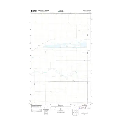
2013 Map of Badger NE
USGS Topo · Published 2013About this map
The Roseau Co landscape near the Canada / United States of America border is defined by a sophisticated network of water management features designed to navigate this low-lying region. Large managed reservoirs like Pool 1 and Pool Number One are interconnected by extensive drainage infrastructure, most notably County Ditch Number Seventeen and Pine Cr Ditch. This engineered hydrology is a hallmark of the northern Minnesota borderlands, where the natural flow of the Roseau River has been supplemented by canals and ditches to control seasonal flooding and support local land use.
Find a feature on this map
18 named features on this map. Tap any name to fly to it.
Don’t see what you’re looking for? This feature index may not catch every label — zoom into the map to look around manually.
Map Details
Editions of this 2013 Badger NE Map
This is the sole edition of this map. No revisions or reprints were ever made.
Other maps of this area

1918 · Roseau
USGS Topo · 1:62,500

1919 · Badger
USGS Topo · 1:62,500

1952 · Thief River Falls
USGS Topo · 1:250,000

1954 · Roseau
USGS Topo · 1:250,000

1956 · Thief River Falls
USGS Topo · 1:250,000

1957 · Roseau
USGS Topo · 1:250,000

1957 · Thief River Falls
USGS Topo · 1:250,000

1958 · Roseau
USGS Topo · 1:250,000

1963 · Kenora
USGS Topo · 1:250,000
1966 · Haug
USGS Topo · 1:24,000