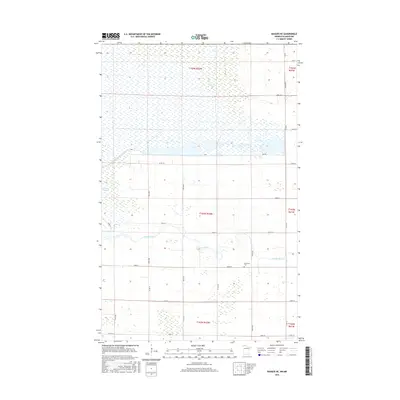
2016 Map of Badger NE
USGS Topo · Published 2016About this map
The meandering Roseau River flows through the heart of this Roseau County landscape, illustrating a complex network of northern Minnesota water management. The northern half of the territory is defined by large-scale impoundments including Pool 1 and Pool Number One, supported by the linear engineering of a Dike and Dike Rd. These features, alongside County Ditch Number Seventeen, reveal the area's transition from natural wetland and prairie into a managed hydrologic system. Evidence of early community life is found at the Immanuel Cem, a focal point for genealogical research in this rural township. Away from the primary river channel, smaller features like the Carlson Pothole punctuate the grid of county roads, such as Co Rd 112 and Co Rd 10, which provide the primary framework for this sparsely settled agricultural and conservation region.
Find a feature on this map
35 named features on this map. Tap any name to fly to it.
Don’t see what you’re looking for? This feature index may not catch every label — zoom into the map to look around manually.
Map Details
Editions of this 2016 Badger NE Map
This is the sole edition of this map. No revisions or reprints were ever made.
Other maps of this area

1918 · Roseau
USGS Topo · 1:62,500

1919 · Badger
USGS Topo · 1:62,500

1952 · Thief River Falls
USGS Topo · 1:250,000

1954 · Roseau
USGS Topo · 1:250,000

1956 · Thief River Falls
USGS Topo · 1:250,000

1957 · Roseau
USGS Topo · 1:250,000

1957 · Thief River Falls
USGS Topo · 1:250,000

1958 · Roseau
USGS Topo · 1:250,000

1963 · Kenora
USGS Topo · 1:250,000
1966 · Haug
USGS Topo · 1:24,000