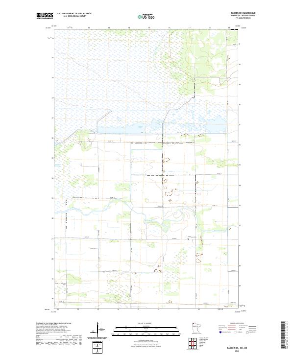
2022 Map of Badger NE
USGS Topo · Published 2022About this map
The Roseau River meanders across this northern Minnesota landscape, where an extensive network of drainage infrastructure like Pine Cr Ditch and County-Ditch-Number-Seventeen reveals the effort required to manage the area's low-lying wetlands. Human settlement in this Roseau County quadrangle is defined by a rigid grid of section lines and gravel roads, including Co RD 112 and Co RD 3, connecting dispersed farmsteads. The landscape is dotted with unique water features such as the Carlson Pothole, while the Immanuel Cem serves as a quiet landmark of the local community. The presence of a Dike and Dike Rd further underscores the historical and ongoing management of the river's floodplain for agricultural use.
Find a feature on this map
32 named features on this map. Tap any name to fly to it.
Don’t see what you’re looking for? This feature index may not catch every label — zoom into the map to look around manually.
Map Details
Editions of this 2022 Badger NE Map
This is the sole edition of this map. No revisions or reprints were ever made.
Other maps of this area

1918 · Roseau
USGS Topo · 1:62,500

1919 · Badger
USGS Topo · 1:62,500

1952 · Thief River Falls
USGS Topo · 1:250,000

1954 · Roseau
USGS Topo · 1:250,000

1956 · Thief River Falls
USGS Topo · 1:250,000

1957 · Roseau
USGS Topo · 1:250,000

1957 · Thief River Falls
USGS Topo · 1:250,000

1958 · Roseau
USGS Topo · 1:250,000

1963 · Kenora
USGS Topo · 1:250,000
1966 · Haug
USGS Topo · 1:24,000