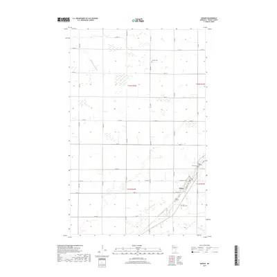
2019 Map of Badger
USGS Topo · Published 2019About this map
The city of Badger serves as the focal point of this northern Minnesota landscape, situated at the intersection of a precise township grid. This 2019 survey illustrates a region defined by extensive drainage management and agricultural development, most notably through the Whitney Lake Ditch and the winding course of the S Br Two Rivers. The distribution of local cemeteries, including Roselund Cem, Swedish Cem, and Badger Creek Cem, reflects the long-standing community foundations in this part of Roseau County. In the southern portion of the quadrangle, the town layout is clearly visible with streets like Skagen Ave and Tamarack St framing the residential and commercial core. This map is particularly useful for genealogists tracing family locations near the Badger City Cem or searching for specific rural landmarks within the boundaries of townships like t162n r42w.
Find a feature on this map
38 named features on this map. Tap any name to fly to it.
Don’t see what you’re looking for? This feature index may not catch every label — zoom into the map to look around manually.
Map Details
Editions of this 2019 Badger Map
This is the sole edition of this map. No revisions or reprints were ever made.
Other maps of this area

1918 · Roseau
USGS Topo · 1:62,500

1918 · Garland
USGS Topo · 1:62,500

1918 · Greenbush
USGS Topo · 1:62,500

1919 · Badger
USGS Topo · 1:62,500

1952 · Thief River Falls
USGS Topo · 1:250,000

1954 · Roseau
USGS Topo · 1:250,000

1956 · Thief River Falls
USGS Topo · 1:250,000

1957 · Roseau
USGS Topo · 1:250,000

1957 · Thief River Falls
USGS Topo · 1:250,000

1958 · Roseau
USGS Topo · 1:250,000