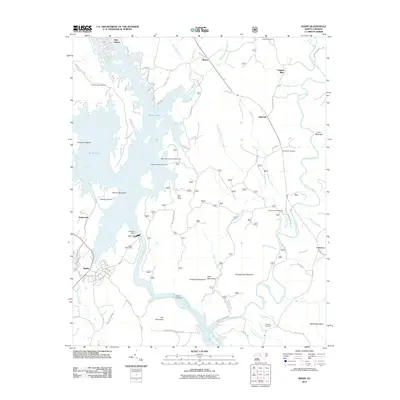
2011 Map of Badin
USGS Topo · Published 2011About this map
The Yadkin River and Pee Dee River define this Piedmont landscape, dominated by a series of hydroelectric developments. Massive water-control structures including Narrows Dam, Badin Dam, and Yadkin Falls Dam have transformed the river valley into Badin Lake and Lake Tillery. These reservoirs surround physical landmarks like Graveyard Island and Palmer Mountain, illustrating the radical topographic shift from a free-flowing river to a managed industrial power source.
Find a feature on this map
110 named features on this map. Tap any name to fly to it.
Don’t see what you’re looking for? This feature index may not catch every label — zoom into the map to look around manually.
Map Details
Editions of this 2011 Badin Map
This is the sole edition of this map. No revisions or reprints were ever made.
Other maps of this area

1942 · Troy
USGS Topo · 1:125,000

1949 · High Rock
USGS Topo · 1:24,000

1953 · Raleigh
USGS Topo · 1:250,000

1953 · Charlotte
USGS Topo · 1:250,000

1954 · Charlotte
USGS Topo · 1:250,000

1954 · Raleigh
USGS Topo · 1:250,000

1957 · Albemarle
USGS Topo · 1:62,500

1957 · Denton
USGS Topo · 1:62,500

1957 · Troy
USGS Topo · 1:62,500

1957 · Asheboro
USGS Topo · 1:62,500