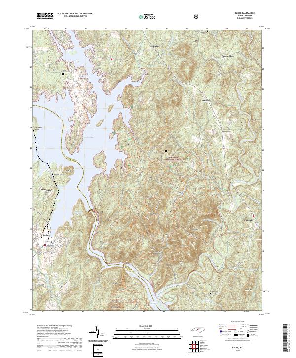
2022 Map of Badin
USGS Topo · Published 2022About this map
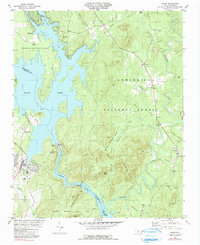
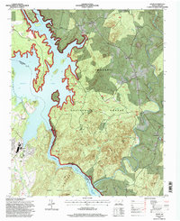
The Uwharrie National Forest dominates this landscape along the border of Montgomery and Stanly counties. This area is defined by the significant impoundments of the Yadkin River, specifically Badin Lake and Lake Tillery, which wrap around the varied terrain of the Uwharrie Mountains. The town of Badin serves as a primary hub near the Narrows of the Yadkin, where the river’s natural course was transformed by hydroelectric development. Small settlements like Eldorado, Blaine, and Palmerville dot the periphery of the forest, reflecting the region's long-standing connection to both timber and mineral extraction.
Find a feature on this map
126 named features on this map. Tap any name to fly to it.
Don’t see what you’re looking for? This feature index may not catch every label — zoom into the map to look around manually.
Map Details
Editions of this 2022 Badin Map
This is the sole edition of this map. No revisions or reprints were ever made.