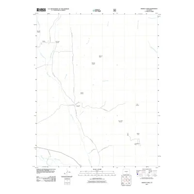
2011 Map of Badito Cone
USGS Topo · Published 2011About this map
Badito Cone rises as a prominent landmark in this arid portion of Huerfano County, where the landscape is defined by deep canyons and intermittent watercourses. The drainage patterns of Custer Creek, Turkey Creek, and Maes Creek create a network of rugged relief, including Reveille Canyon and Gomez Canyon. Historical land use is evident in the presence of the Garcia Ditch and the Stumbling Stud Mine, indicating a local economy once tied to irrigation and mineral extraction. The map preserves the locations of family-named sites essential for genealogical research, such as the Cisneros Cemetery and Maes Creek Cemetery. To the south, the Huerfano River serves as the primary hydrological feature, drawing together various arroyos and canyons like Arroyo Hondo and South Red Canyon into its broader valley.
Find a feature on this map
28 named features on this map. Tap any name to fly to it.
Don’t see what you’re looking for? This feature index may not catch every label — zoom into the map to look around manually.
Map Details
Editions of this 2011 Badito Cone Map
This is the sole edition of this map. No revisions or reprints were ever made.
Other maps of this area

1889 · Huerfano Park
USGS Topo · 1:125,000

1891 · Walsenburg
USGS Topo · 1:125,000

1892 · Huerfano Park
USGS Topo · 1:125,000

1894 · Walsenburg
USGS Topo · 1:125,000

1897 · Walsenburg
USGS Topo · 1:125,000

1900 · Walsenburg
USGS Topo · 1:125,000

1954 · Trinidad
USGS Topo · 1:250,000

1955 · Trinidad
USGS Topo · 1:250,000

1958 · Trinidad
USGS Topo · 1:250,000

1959 · Trinidad
USGS Topo · 1:250,000