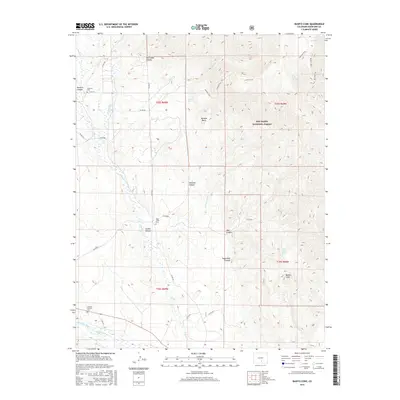
2016 Map of Badito Cone
USGS Topo · Published 2016About this map
The Huerfano River flows across the southwestern corner of this landscape, where the Garcia Ditch highlights the historical importance of water management in this arid region. The terrain is defined by dramatic geological features such as Badito Cone and Santana Butte, while deep drainages like Dry Creek Canyon and Santana Canyon cut through the high country. Portions of the San Isabel National Forest dominate the eastern half of the map, accessed by historic routes like the Santana Trail and Bartlett Trail. Genealogy researchers will find several localized burial sites, including the Gardner Catholic Cem near the river and the more remote Cisneros Cem and Maes Creek Cem. Scattered springs, such as Saint Jude Spring and Santana Spring, provide vital water points for the high-altitude trails and canyon systems.
Find a feature on this map
39 named features on this map. Tap any name to fly to it.
Don’t see what you’re looking for? This feature index may not catch every label — zoom into the map to look around manually.
Map Details
Editions of this 2016 Badito Cone Map
This is the sole edition of this map. No revisions or reprints were ever made.
Other maps of this area

1889 · Huerfano Park
USGS Topo · 1:125,000

1891 · Walsenburg
USGS Topo · 1:125,000

1892 · Huerfano Park
USGS Topo · 1:125,000

1894 · Walsenburg
USGS Topo · 1:125,000

1897 · Walsenburg
USGS Topo · 1:125,000

1900 · Walsenburg
USGS Topo · 1:125,000

1954 · Trinidad
USGS Topo · 1:250,000

1955 · Trinidad
USGS Topo · 1:250,000

1958 · Trinidad
USGS Topo · 1:250,000

1959 · Trinidad
USGS Topo · 1:250,000