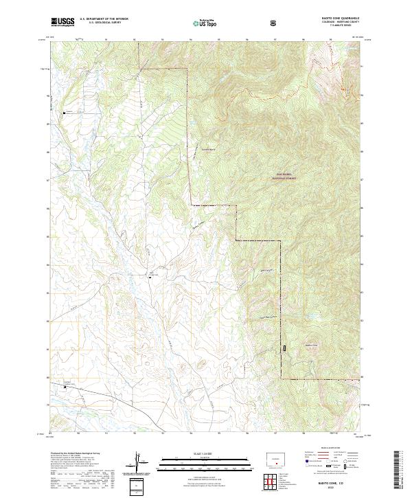
2022 Map of Badito Cone
USGS Topo · Published 2022About this map
San Isabel National Forest dominates the eastern landscape of this Huerfano County region, where the high desert meets the rising eastern slopes of the mountains. The southern edge of the survey follows the path of the Huerfano River, supported by irrigation features like the Garcia Ditch. Genealogists will find several family-named burial sites across the territory, including the Cisneros Cem near Reveille Canyon, the Maes Creek Cem, and the Gardner Catholic Cem to the south. Distinctive geological features like Badito Cone and Santana Butte provide vertical relief among a network of drainages such as Gomez Canyon and Arroyo Hondo. This modern topographic study shows a rural landscape defined by ranch roads and water sources like Santana Spring and Saint Jude Spring, illustrating the persistent reliance on natural springs and river-valley access in this part of Colorado.
Find a feature on this map
40 named features on this map. Tap any name to fly to it.
Don’t see what you’re looking for? This feature index may not catch every label — zoom into the map to look around manually.
Map Details
Editions of this 2022 Badito Cone Map
This is the sole edition of this map. No revisions or reprints were ever made.
Other maps of this area

1889 · Huerfano Park
USGS Topo · 1:125,000

1891 · Walsenburg
USGS Topo · 1:125,000

1892 · Huerfano Park
USGS Topo · 1:125,000

1894 · Walsenburg
USGS Topo · 1:125,000

1897 · Walsenburg
USGS Topo · 1:125,000

1900 · Walsenburg
USGS Topo · 1:125,000

1954 · Trinidad
USGS Topo · 1:250,000

1955 · Trinidad
USGS Topo · 1:250,000

1958 · Trinidad
USGS Topo · 1:250,000

1959 · Trinidad
USGS Topo · 1:250,000