
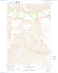
1951 Map of Badnation NW
USGS Topo · Published 1953About this map
The meandering White River defines the central landscape of this 1951 survey, carving a deep valley through the high plains of South Dakota along the border of Jones and Mellette counties. This map captures the topography of the Missouri River Basin development era, showcasing the drainage systems of White Thunder Creek and Squaw Creek as they feed into the primary river channel. Named townships and local districts such as Zickrick, Williams Creek, and Riverside indicate the sparse but organized settlement patterns of the period. To the south, the terrain rises toward the areas of Cody and Badnation, where intricate contour lines illustrate the sharp breaks and draws characteristic of this section of the Great Plains. The map provides an essential record of the natural watercourses and legal land divisions before significant modern agricultural or infrastructural changes altered the local landscape.
Find a feature on this map
10 named features on this map. Tap any name to fly to it.
Don’t see what you’re looking for? This feature index may not catch every label — zoom into the map to look around manually.
Map Details
Editions of this 1951 Badnation NW Map
2 editions found
Other maps of this area

1951 · Murdo SE
USGS Topo · 1:24,000

1951 · Badnation
USGS Topo · 1:24,000

1951 · White River NE
USGS Topo · 1:24,000

1955 · Martin
USGS Topo · 1:250,000

1958 · Martin
USGS Topo · 1:250,000

1970 · Vivian SW
USGS Topo · 1:24,000

1972 · Vivian SE
USGS Topo · 1:24,000

1982 · White River SE
USGS Topo · 1:24,000

1982 · Wood North
USGS Topo · 1:24,000

1982 · Badnation SE
USGS Topo · 1:25,000