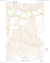
1951 Map of Badnation NW
USGS Topo · Published 1979About this map
The White River meanders through this portion of the northern plains, carving a distinct boundary between Jones and Mellette counties. Mapped in 1951 with revisions in the late 1970s, the terrain is characterized by the intricate drainage systems of Thunder Creek, Williams Creek, and Bull Creek as they feed into the primary river valley. The landscape is defined by its administrative townships, including Badnation, Riverside, and Cody. This survey, produced as part of the Department of the Interior's Missouri River Basin development program, captures a specialized view of the Dakota prairie before significant modern infrastructure expansion, highlighting the complex natural topography and the sparse, isolated network of improved and unimproved roads that connected these rural townships.
Find a feature on this map
8 named features on this map. Tap any name to fly to it.
Don’t see what you’re looking for? This feature index may not catch every label — zoom into the map to look around manually.
Map Details
Editions of this 1951 Badnation NW Map
2 editions found
Other maps of this area

1951 · Murdo SE
USGS Topo · 1:24,000

1951 · Badnation
USGS Topo · 1:24,000

1951 · White River NE
USGS Topo · 1:24,000

1951 · Badnation NW
USGS Topo · 1:24,000

1955 · Martin
USGS Topo · 1:250,000

1958 · Martin
USGS Topo · 1:250,000

1970 · Vivian SW
USGS Topo · 1:24,000

1972 · Vivian SE
USGS Topo · 1:24,000

1982 · White River SE
USGS Topo · 1:24,000

1982 · Wood North
USGS Topo · 1:24,000