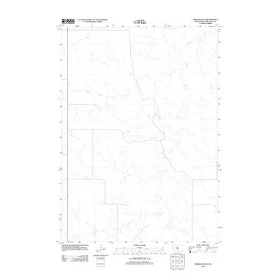
2012 Map of Badnation SE
USGS Topo · Published 2012About this map
Butte Creek and Oak Creek define the drainage patterns of this Mellette County landscape as documented in the early 21st century. The terrain is characterized by a network of intermittent stream beds and prairie drainages, including Louis Creek in the north and McChesneys Creek to the south. This area, located within the Butte Creek segment, shows a sparse road network typical of rural South Dakota ranching country. The U.S. Geological Survey mapping reveals the intricate natural topography of the Plains before further modern development, focusing on the hydrologic features that have historically dictated land use and settlement patterns in this part of the state.
Find a feature on this map
4 named features on this map. Tap any name to fly to it.
Don’t see what you’re looking for? This feature index may not catch every label — zoom into the map to look around manually.
Map Details
Editions of this 2012 Badnation SE Map
This is the sole edition of this map. No revisions or reprints were ever made.
Other maps of this area

1951 · Badnation
USGS Topo · 1:24,000

1951 · Badnation NW
USGS Topo · 1:24,000

1951 · Presho 4 NW
USGS Topo · 1:24,000

1955 · Martin
USGS Topo · 1:250,000

1958 · Martin
USGS Topo · 1:250,000

1982 · Two Nation Creek
USGS Topo · 1:25,000

1982 · Wood North
USGS Topo · 1:24,000

1982 · Badnation SE
USGS Topo · 1:25,000
1982 · Carter
USGS Topo · 1:25,000

1982 · Mosher
USGS Topo · 1:25,000