
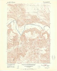
1951 Map of Presho 4 NW
USGS Topo · Published 1953About this map
The White River carves a winding path through this portion of Tripp County in the early 1950s, defining the rugged transition between the Bad Nation and River Side terrain. This survey reflects a sparsely populated ranching landscape where isolated homesteads like Krutson Ranch and Iverson Ranch serve as primary landmarks across the rolling breaks. The mapping, conducted for the Department of the Interior's Missouri River Basin development program, provides a detailed look at the drainage network feeding the main river, including Medicine Creek, Oak Creek, and Little Dog Creek. Institutional presence is minimal, anchored by the Pleasant Hill Sch in the northern uplands, while the economy is further evidenced by scattered Gravel Pits used for local infrastructure during this post-war period.
Find a feature on this map
13 named features on this map. Tap any name to fly to it.
Don’t see what you’re looking for? This feature index may not catch every label — zoom into the map to look around manually.
Map Details
Editions of this 1951 Presho 4 NW Map
4 editions found
Other maps of this area

1951 · Badnation
USGS Topo · 1:24,000

1951 · Presho 4 NE
USGS Topo · 1:24,000

1955 · Martin
USGS Topo · 1:250,000

1958 · Martin
USGS Topo · 1:250,000

1972 · Vivian SE
USGS Topo · 1:24,000
1978 · Presho SE
USGS Topo · 1:24,000

1978 · Presho SW
USGS Topo · 1:24,000

1982 · Presho 4 SE
USGS Topo · 1:25,000

1982 · Two Nation Creek
USGS Topo · 1:25,000

1982 · Badnation SE
USGS Topo · 1:25,000