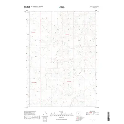
2017 Map of Badnation SE
USGS Topo · Published 2017About this map
Butte Cr and McChesneys Cr define the southern drainage of this Mellette County landscape, where the terrain transitions into a network of intermittent watercourses including Louis Cr and Oak Cr. The map reveals a strictly regulated grid of section lines and rural thoroughfares that dictate the movement across this prairie environment. A distinctive local route, Bad Whichwind Rd, cuts across the central townships, diverging from the standard numerical grid of 267th St and 290th Ave. This layout reflects the enduring influence of the Public Land Survey System, with the land divided into the townships of t42n r26w and t41n r25w. This 2017 survey provides a precise look at the modern rural infrastructure and natural hydrology of the Butte Creek Segment.
Find a feature on this map
18 named features on this map. Tap any name to fly to it.
Don’t see what you’re looking for? This feature index may not catch every label — zoom into the map to look around manually.
Map Details
Editions of this 2017 Badnation SE Map
This is the sole edition of this map. No revisions or reprints were ever made.
Other maps of this area

1951 · Badnation
USGS Topo · 1:24,000

1951 · Badnation NW
USGS Topo · 1:24,000

1951 · Presho 4 NW
USGS Topo · 1:24,000

1955 · Martin
USGS Topo · 1:250,000

1958 · Martin
USGS Topo · 1:250,000

1982 · Two Nation Creek
USGS Topo · 1:25,000

1982 · Wood North
USGS Topo · 1:24,000

1982 · Badnation SE
USGS Topo · 1:25,000
1982 · Carter
USGS Topo · 1:25,000

1982 · Mosher
USGS Topo · 1:25,000