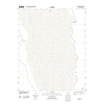
2012 Map of Badwater
USGS Topo · Published 2012About this map
Death Valley dominates this 2012 topographic study of one of the lowest points in North America. The map highlights the unique hydrology of the basin, featuring the Amargosa River as it traverses the salt flats and the presence of Eagle Borax Spring, a critical water source in this arid environment. Transportation through the valley is limited to the north-south corridor of the W Side Hwy and the utility-focused Eagle Borax Well Rd. Dramatic geological features such as Coffin Canyon and Copper Canyon are carved into the eastern mountain front, illustrating the extreme relief adjacent to the Badwater basin. This survey provides an essential view of the desert landscape's natural features and primitive road network in the early 21st century.
Find a feature on this map
9 named features on this map. Tap any name to fly to it.
Don’t see what you’re looking for? This feature index may not catch every label — zoom into the map to look around manually.
Map Details
Editions of this 2012 Badwater Map
This is the sole edition of this map. No revisions or reprints were ever made.
Other maps of this area

1908 · Furnace Creek
USGS Topo · 1:250,000

1910 · Furnace Creek
USGS Topo · 1:250,000

1948 · Death Valley
USGS Topo · 1:250,000

1951 · Funeral Peak
USGS Topo · 1:62,500

1952 · Furnace Creek
USGS Topo · 1:62,500

1952 · Ryan
USGS Topo · 1:62,500

1952 · Bennetts Well
USGS Topo · 1:62,500

1954 · Death Valley
USGS Topo · 1:250,000

1956 · Death Valley
USGS Topo · 1:250,000

1957 · Death Valley
USGS Topo · 1:250,000