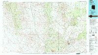
1979 Map of Bagdad
USGS Topo · Published 1997About this map
Mining operations and sprawling high-desert mesas dominate this 1970s landscape at the border of Mohave and Yavapai counties. The town of Bagdad serves as a focal point for industrial activity, surrounded by a high density of mineral claims including the Bonanza Mine, Graphite State Mine, and the Boriana Mines. To the north, the large land grant of Luis Maria Baca Float No 5 stretches across the Mohon Mountains, while the Aquarius Mountains and Hualapai Mountains frame the central valleys. This survey illustrates the reliance on groundwater in this arid environment, evidenced by isolated outposts such as Coors Well, James Well, and Stouts Well. The transition from the rugged peaks to the flat expanse of Dutch Flat is marked by numerous seasonal drainages like Burro Creek and Sycamore Creek, which define the natural corridors through this complex topography.
Find a feature on this map
63 named features on this map. Tap any name to fly to it.
Don’t see what you’re looking for? This feature index may not catch every label — zoom into the map to look around manually.
Map Details
Editions of this 1979 Bagdad Map
2 editions found
Other maps of this area

1886 · Diamond Creek
USGS Topo · 1:250,000

1886 · Camp Mohave
USGS Topo · 1:250,000

1886 · Chino
USGS Topo · 1:250,000

1887 · Prescott
USGS Topo · 1:250,000

1891 · Chino
USGS Topo · 1:250,000

1892 · Diamond Creek
USGS Topo · 1:250,000

1892 · Camp Mohave
USGS Topo · 1:250,000

1892 · Prescott
USGS Topo · 1:250,000

1903 · Congress
USGS Topo · 1:125,000

1904 · Congress
USGS Topo · 1:125,000