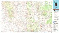
1979 Map of Bagdad
USGS Topo · Published 1997About this map
Mining operations and high desert mesas dominate this 1970s landscape of Western Arizona, centered on the copper-rich vicinity of Bagdad. The map reveals an industrial interior defined by the Copper Cr Mine and Hillside Mine, while the vast Luis Maria Baca Float No 5 land grant and the Hualapai Indian Res mark significant historical boundaries. A complex network of water sources, from the Big Sandy River to isolated points like Wabayuma Spring and Old Ranch Well, illustrates the essential infrastructure required for survival and industry in this arid environment.
Find a feature on this map
119 named features on this map. Tap any name to fly to it.
Don’t see what you’re looking for? This feature index may not catch every label — zoom into the map to look around manually.
Map Details
Editions of this 1979 Bagdad Map
2 editions found
Other maps of this area

1886 · Diamond Creek
USGS Topo · 1:250,000

1886 · Camp Mohave
USGS Topo · 1:250,000

1886 · Chino
USGS Topo · 1:250,000

1887 · Prescott
USGS Topo · 1:250,000

1891 · Chino
USGS Topo · 1:250,000

1892 · Diamond Creek
USGS Topo · 1:250,000

1892 · Camp Mohave
USGS Topo · 1:250,000

1892 · Prescott
USGS Topo · 1:250,000

1903 · Congress
USGS Topo · 1:125,000

1904 · Congress
USGS Topo · 1:125,000