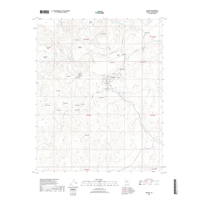
2018 Map of Bagdad
USGS Topo · Published 2018About this map
Bagdad sits at the heart of this Yavapai County terrain, serving as a concentrated point of industry and settlement surrounded by a network of high mesas and prominent peaks. The map reveals a land structured by its geology, with features like Copper Creek Mesa, Nelson Mesa, and Centipede Mesa defining the horizons. Transportation is anchored by the Bagdad Airport and a grid of specialized routes such as Mine RD and Mine Shop RD, which underscore the area's extraction-based history. Water management and natural drainage are evident in the winding courses of Mineral Cr, Bridle Cr, and Cowboy Wash. Elevations vary sharply across landmarks like Granite Mtn and the Cowboy Peaks, while the town itself is detailed with residential streets and a Po, providing a clear view of the community's footprint in the late 2010s.
Find a feature on this map
70 named features on this map. Tap any name to fly to it.
Don’t see what you’re looking for? This feature index may not catch every label — zoom into the map to look around manually.
Map Details
Editions of this 2018 Bagdad Map
This is the sole edition of this map. No revisions or reprints were ever made.
Other maps of this area

1923 · Signal
USGS Topo · 1:250,000

1942 · Signal
USGS Topo · 1:250,000

1945 · Bagdad
USGS Topo · 1:62,500

1948 · Bagdad
USGS Topo · 1:62,500

1950 · Prescott
USGS Topo · 1:250,000

1954 · Prescott
USGS Topo · 1:250,000

1958 · Prescott
USGS Topo · 1:250,000

1959 · Prescott
USGS Topo · 1:250,000

1960 · Prescott
USGS Topo · 1:250,000

1965 · Prescott
USGS Topo · 1:250,000