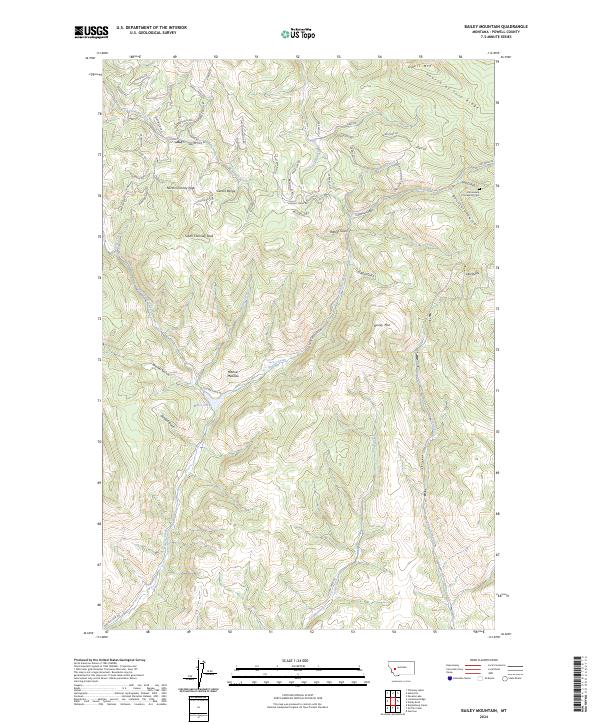
2024 Map of Bailey Mountain
USGS Topo · Published 2024About this map
The Garnet Range dominates this landscape in Powell County, where high peaks like North Chimney Peak and South Chimney Peak overlook a complex network of canyons and gulches. The northern portion of the map is preserved within the Blackfoot Valley Conservation Area, indicating a modern emphasis on habitat protection in this high-altitude terrain. A remote mountain cemetery, Immaculate Conception Cem, sits near Salt Gulch and Buckskin Gulch, serving as a rare marker of historic human presence in an area otherwise defined by drainage systems and named ridges. Numerous small watercourses, including Hoover Creek and Gough Creek, carve through the topography toward Miller Lake. The naming conventions of the local roads, such as Beaverslide Rd, Cat-Track Rd, and Powderhorn Rd, reflect the region's long-standing connection to outdoor recreation and wilderness navigation.
Find a feature on this map
65 named features on this map. Tap any name to fly to it.
Don’t see what you’re looking for? This feature index may not catch every label — zoom into the map to look around manually.
Map Details
Editions of this 2024 Bailey Mountain Map
This is the sole edition of this map. No revisions or reprints were ever made.
Other maps of this area

1889 · Helena
USGS Topo · 1:250,000

1893 · Helena
USGS Topo · 1:250,000

1899 · Helena
USGS Topo · 1:250,000

1903 · Helena
USGS Topo · 1:250,000

1919 · Drummond
USGS Topo · 1:125,000

1921 · Drummond
USGS Topo · 1:125,000

1947 · Butte
USGS Topo · 1:250,000

1958 · Butte
USGS Topo · 1:250,000

1958 · Drummond
USGS Topo · 1:62,500

1958 · Garrison
USGS Topo · 1:62,500