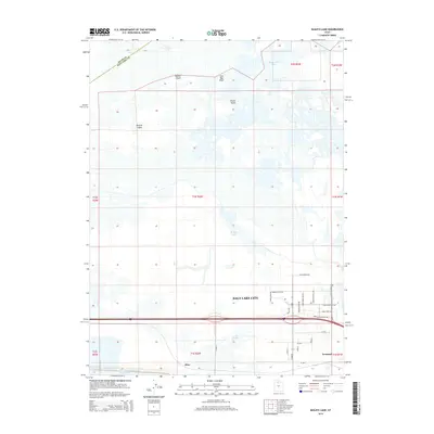
2014 Map of Baileys Lake
USGS Topo · Published 2014About this map
Farmington Bay and the marshy edges of the Great Salt Lake dominate this 2014 survey, illustrating the complex intersection of industrial land use and the terminal lake's unique hydrology. The landscape is punctuated by prominent terrain features such as Browns Island, Rabbit Knoll, and Round Knoll, which rise above the surrounding wetlands and salt flats. To the south, the massive scale of the Kennecott Tailings Pond Number One reflects the region's significant mining legacy, while Salt Spring and Baileys Lake highlight the area's natural water features.
Find a feature on this map
40 named features on this map. Tap any name to fly to it.
Don’t see what you’re looking for? This feature index may not catch every label — zoom into the map to look around manually.
Map Details
Editions of this 2014 Baileys Lake Map
This is the sole edition of this map. No revisions or reprints were ever made.
Other maps of this area

1885 · Salt Lake
USGS Topo · 1:250,000

1885 · Tooele Valley
USGS Topo · 1:250,000

1925 · Ft. Douglas
USGS Topo · 1:125,000

1928 · Ft. Douglas
USGS Topo · 1:125,000

1951 · Saltair
USGS Topo · 1:24,000

1951 · Salt Lake City South
USGS Topo · 1:24,000

1951 · Salt Lake City North
USGS Topo · 1:24,000

1952 · Saltair NE
USGS Topo · 1:24,000

1952 · Farmington
USGS Topo · 1:24,000

1952 · Magna
USGS Topo · 1:24,000