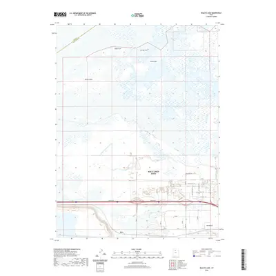
2020 Map of Baileys Lake
USGS Topo · Published 2020About this map
Farmington Bay and the marshy edges of the Great Salt Lake dominate this portion of the Salt Lake City metropolitan fringe. The landscape is a study in the intersection of natural hydrology and aviation history, where the expansive wetlands surrounding Baileys Lake and Salt Spring meet the industrial developments of the Terminal district. This area reflects the mid-20th-century aviation boom, with streets named for pioneers of flight, including Amelia Earhart Dr, Wiley Post Way, and Jimmy Doolittle RD. To the west, the terrain transitions into a series of distinctive topographic features rising above the flats, such as Browns Island, Rabbit Knoll, and Cow Bay Knoll. The presence of the N Point Consolidated Canal and the settlement of Riter further highlight the historical efforts to manage this unique basin's water resources and transport needs.
Find a feature on this map
34 named features on this map. Tap any name to fly to it.
Don’t see what you’re looking for? This feature index may not catch every label — zoom into the map to look around manually.
Map Details
Editions of this 2020 Baileys Lake Map
This is the sole edition of this map. No revisions or reprints were ever made.
Other maps of this area

1885 · Salt Lake
USGS Topo · 1:250,000

1885 · Tooele Valley
USGS Topo · 1:250,000

1925 · Ft. Douglas
USGS Topo · 1:125,000

1928 · Ft. Douglas
USGS Topo · 1:125,000

1951 · Saltair
USGS Topo · 1:24,000

1951 · Salt Lake City South
USGS Topo · 1:24,000

1951 · Salt Lake City North
USGS Topo · 1:24,000

1952 · Saltair NE
USGS Topo · 1:24,000

1952 · Farmington
USGS Topo · 1:24,000

1952 · Magna
USGS Topo · 1:24,000