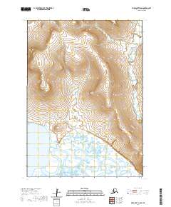
2020 Map of Baird Inlet C-8 SW
USGS Topo · Published 2020About this map
The village of Nightmute sits on the eastern edge of this landscape, positioned where the intricate wetlands of the Yukon-Kuskokwim Delta meet the tidal influence of Kangerlvar Bay. This 2020 survey reveals a coastal environment dominated by the meandering Toksook River and the Ikalugtulik River, which thread through an expansive network of ponds and marshes. The terrain is remarkably low-lying, with the exception of Kasinuk Mtn, a distinct topographic rise that provides a rare point of elevation overlooking the surrounding tundra and river systems. The map illustrates a subsistence landscape where the proximity of the settlement to both the river and the bay suggests a reliance on the seasonal rhythms of the water and the land.
Find a feature on this map
9 named features on this map. Tap any name to fly to it.
Don’t see what you’re looking for? This feature index may not catch every label — zoom into the map to look around manually.
Map Details
Editions of this 2020 Baird Inlet C-8 SW Map
This is the sole edition of this map. No revisions or reprints were ever made.
Other maps of this area

1951 · Nunivak Island
USGS Topo · 1:250,000

1951 · Baird Inlet
USGS Topo · 1:250,000

1954 · Nunivak Island
USGS Topo · 1:250,000

1954 · Baird Inlet
USGS Topo · 1:250,000

1954 · Baird Inlet C-8
USGS Topo · 1:63,360

1954 · Nunivak Island B-1
USGS Topo · 1:63,360

1954 · Baird Inlet B-8
USGS Topo · 1:63,360

1954 · Nunivak Island C-1
USGS Topo · 1:63,360

1958 · Nunivak Island
USGS Topo · 1:250,000

1964 · Nunivak Island
USGS Topo · 1:250,000