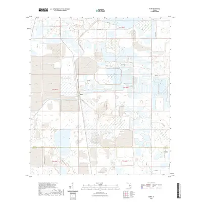
2021 Map of Baird
USGS Topo · Published 2021About this map
Baird and Fort Green anchor this interior Florida landscape at the border of Polk and Hardee Counties. The terrain is defined by a complex network of wetlands and drainage patterns, including Hookers Prairie and the headwaters of Payne Cr. The map reveals a transition between heavy industry and recreation, with massive earthwork formations and settling ponds characteristic of phosphate mining dominating the northern half of the quadrangle. Conversely, the southern portion transitions into protected space near the Hardee Lakes Park Trl. Genealogy researchers will find the Paynes Creek Primitive Cem situated near the banks of Little Payne Creek, a quiet landmark in a landscape of shifting land use. The historical road network, including Old Hwy 37 and Old Brewster Rd, provides a framework for understanding the region's 20th-century development and transport routes.
Find a feature on this map
27 named features on this map. Tap any name to fly to it.
Don’t see what you’re looking for? This feature index may not catch every label — zoom into the map to look around manually.
Map Details
Editions of this 2021 Baird Map
This is the sole edition of this map. No revisions or reprints were ever made.
Other maps of this area

1949 · Bradley Junction
USGS Topo · 1:24,000

1950 · Bradley Junction
USGS Topo · 1:24,000

1952 · Homeland
USGS Topo · 1:24,000

1955 · Ft. Green
USGS Topo · 1:24,000

1955 · Bowling Green
USGS Topo · 1:24,000

1955 · Wauchula
USGS Topo · 1:24,000

1955 · Baird
USGS Topo · 1:24,000

1955 · Keysville
USGS Topo · 1:24,000

1956 · Duette NE
USGS Topo · 1:24,000

1956 · Duette
USGS Topo · 1:24,000