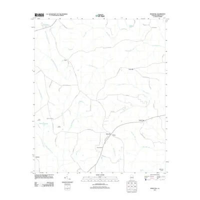
2011 Map of Baker Hill
USGS Topo · Published 2011About this map
Baker Hill anchors this rural Barbour County landscape, characterized by the sharp rise of the Baker Hill Cuesta and a dense network of creek branches. The area is marked by numerous family and community landmarks, including the Sardis Cemetery and New Hope Cemetery. Water is a defining feature of the topography, with the East Fork Choctawhatchee River and its many tributaries, such as Sally Hole Branch and Wilson Branch, carving through the terrain. Small, established settlements like Gaino, Sandy Point, and the evocatively named Peggy Bottom reflect a pattern of localized rural centers. The map also records industrial and agricultural water management at Williams Millpond, while the Baker Hill Post Office serves as the central hub for the surrounding community and its scattered farmsteads.
Find a feature on this map
59 named features on this map. Tap any name to fly to it.
Don’t see what you’re looking for? This feature index may not catch every label — zoom into the map to look around manually.
Map Details
Editions of this 2011 Baker Hill Map
This is the sole edition of this map. No revisions or reprints were ever made.
Other maps of this area

1953 · Dothan
USGS Topo · 1:250,000

1954 · Dothan
USGS Topo · 1:250,000

1955 · Dothan
USGS Topo · 1:250,000

1967 · Clayton South
USGS Topo · 1:24,000

1968 · Eufaula North
USGS Topo · 1:24,000

1968 · Baker Hill
USGS Topo · 1:24,000

1968 · White Oak
USGS Topo · 1:24,000

1968 · Clayton North
USGS Topo · 1:24,000

1968 · Eufaula South
USGS Topo · 1:24,000

1969 · Fort Gaines NW
USGS Topo · 1:24,000