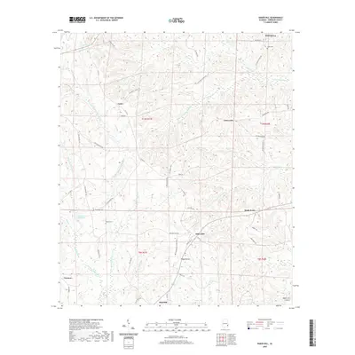
2020 Map of Baker Hill
USGS Topo · Published 2020About this map
Baker Hill and the surrounding Barbour County landscape are defined by a complex network of waterways, including the E Fork Choctawhatchee River and Chipola Creek. This area of Alabama exhibits a traditional rural settlement pattern centered on small communities like Gaino, Cotton Hill, and Sandy Point. For family historians, the presence of several established burial grounds such as Sardis Cem, Scotch Cem, and Walker Cem provides critical anchors for local genealogy. The southern portion of the map is dominated by the Baker Hill Cuesta, a distinct geological landform that influences the drainage of local tributaries like Wilson Br and Piney Woods Cr. Smaller locales like Peggy Bottom and Oateston illustrate the persisting identity of named places across the county's rolling terrain, while Williams Millpond marks the site of historical water management in the region.
Find a feature on this map
63 named features on this map. Tap any name to fly to it.
Don’t see what you’re looking for? This feature index may not catch every label — zoom into the map to look around manually.
Map Details
Editions of this 2020 Baker Hill Map
This is the sole edition of this map. No revisions or reprints were ever made.
Other maps of this area

1953 · Dothan
USGS Topo · 1:250,000

1954 · Dothan
USGS Topo · 1:250,000

1955 · Dothan
USGS Topo · 1:250,000

1967 · Clayton South
USGS Topo · 1:24,000

1968 · Eufaula North
USGS Topo · 1:24,000

1968 · Baker Hill
USGS Topo · 1:24,000

1968 · White Oak
USGS Topo · 1:24,000

1968 · Clayton North
USGS Topo · 1:24,000

1968 · Eufaula South
USGS Topo · 1:24,000

1969 · Fort Gaines NW
USGS Topo · 1:24,000