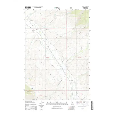
2017 Map of Baker
USGS Topo · Published 2017About this map
The settlement of Baker serves as a focal point within the Lemhi Valley, where the Lemhi River carves a fertile path between the high elevations of the Lemhi Range and the western edge of the Salmon National Forest. This 2017 topographic survey highlights the enduring rural infrastructure of Lemhi County, where modern transit routes often follow historical paths, such as the Red Rock Stage Rd and the Old Baker Hwy. Numerous family-named landmarks and ranch roads, including Skinner Ranch Rd, Mulkey Ln, and Bowman Ln, offer a record of local land use and ownership. The map documents a complex drainage system feeding the river, with prominent watercourses like Bohannon Cr, Wimpey Cr, and Pratt Cr descending from the surrounding heights to the valley floor.
Find a feature on this map
43 named features on this map. Tap any name to fly to it.
Don’t see what you’re looking for? This feature index may not catch every label — zoom into the map to look around manually.
Map Details
Editions of this 2017 Baker Map
This is the sole edition of this map. No revisions or reprints were ever made.
Other maps of this area

1950 · Salmon
USGS Topo · 1:62,500

1951 · Salmon
USGS Topo · 1:62,500

1955 · Dubois
USGS Topo · 1:250,000

1955 · Dillon
USGS Topo · 1:250,000

1956 · Goldstone Mtn
USGS Topo · 1:62,500

1956 · Lemhi
USGS Topo · 1:62,500

1957 · Dillon
USGS Topo · 1:250,000

1958 · Dubois
USGS Topo · 1:250,000

1958 · Dillon
USGS Topo · 1:250,000

1962 · Dillon
USGS Topo · 1:250,000