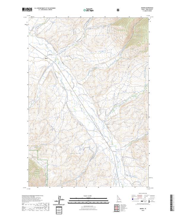
2024 Map of Baker
USGS Topo · Published 2024About this map
Baker sits at the heart of this valley landscape where the Lemhi River flows northwest, fed by numerous creeks descending from the surrounding heights. The settlement serves as a central point for a network of local thoroughfares including Old Baker Hwy and Red Rock Stage Rd, reflecting the historical transportation corridors of Lemhi County. The eastern slopes of the Lemhi Range dominate the southern portion of the map, with drainages like Kadletz Creek and Price Creek carving through the terrain. To the southwest, the boundary of the Salmon National Forest marks a transition into protected wilderness. The drainage patterns of Sandy Creek and Wimpey Creek illustrate the irrigation-dependent geography of the valley floor, while routes like Pratt Creek Trl provide access to the higher elevations of the backcountry.
Find a feature on this map
41 named features on this map. Tap any name to fly to it.
Don’t see what you’re looking for? This feature index may not catch every label — zoom into the map to look around manually.
Map Details
Editions of this 2024 Baker Map
This is the sole edition of this map. No revisions or reprints were ever made.
Other maps of this area

1950 · Salmon
USGS Topo · 1:62,500

1951 · Salmon
USGS Topo · 1:62,500

1955 · Dubois
USGS Topo · 1:250,000

1955 · Dillon
USGS Topo · 1:250,000

1956 · Goldstone Mtn
USGS Topo · 1:62,500

1956 · Lemhi
USGS Topo · 1:62,500

1957 · Dillon
USGS Topo · 1:250,000

1958 · Dubois
USGS Topo · 1:250,000

1958 · Dillon
USGS Topo · 1:250,000

1962 · Dillon
USGS Topo · 1:250,000