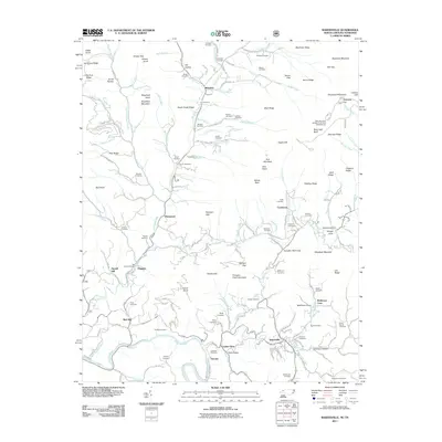
2011 Map of Bakersville
USGS Topo · Published 2011About this map
Bakersville and its surrounding mountain gaps characterize this 2011 Mitchell County survey, which reveals a landscape defined by steep ridges and deep family histories. The settlement of Loafers Glory sits at a junction of valley roads, while Toecane and Red Hill anchor the southern reaches along the North Toe River. This area is dense with genealogical interest, preserving dozens of family-named burial grounds such as the Campbell Cemetery, Blevins Cemetery, and Green Young Cemetery. The topography rises sharply toward the east, culminating at Roan High Bluff and Beartown Mountain. These heights are broken by historic mountain passes like TollHouse Gap and Sarvis Gap, which long served as the primary conduits for travel between isolated communities like Buladean and Cooktown. The map captures the enduring rural character of the region, where numerous named branches and creeks like Big Rock Creek and Cane Creek dictate the layout of small settlements and family farms.
Find a feature on this map
160 named features on this map. Tap any name to fly to it.
Don’t see what you’re looking for? This feature index may not catch every label — zoom into the map to look around manually.
Map Details
Editions of this 2011 Bakersville Map
This is the sole edition of this map. No revisions or reprints were ever made.
Other maps of this area

1891 · Roan Mountain
USGS Topo · 1:125,000

1894 · Roan Mountain
USGS Topo · 1:125,000

1900 · Mount Mitchell
USGS Topo · 1:125,000

1902 · Mount Mitchell
USGS Topo · 1:125,000

1904 · Roan Mountain
USGS Topo · 1:125,000

1934 · Micaville
USGS Topo · 1:24,000

1934 · Spruce Pine
USGS Topo · 1:24,000

1934 · White Rocks Mtn
USGS Topo · 1:24,000

1934 · Bakersville
USGS Topo · 1:24,000

1934 · Iron Mtn Gap
USGS Topo · 1:24,000