
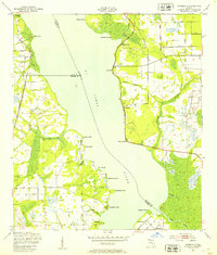
1937 Map of Bakersville
USGS Topo · Published 1937About this map
Bakersville and the surrounding St. Johns County wetlands are captured here just before World War II, showcasing a landscape defined by extensive drainage networks and early transport corridors. The map highlights the intersection of the St Augustine Stage Road and Old Kings Road, tracing historic routes through a complex system of marshes including Six Mile Swamp and Turnbull Swamp. Rural life is anchored by the Bakersville Ch and the Mill Creek Sch, while more curious landmarks like the Theatrical Troop Monument and the enigmatically named Glimpse of Glory hint at local lore. The presence of a Fire Observation Tower and the tracks of the Florida East Coast railway underscore the region's 1930s infrastructure, balancing timber management with the burgeoning coastal travel along the Florida East Coast US Hwy No 1.
Find a feature on this map
27 named features on this map. Tap any name to fly to it.
Don’t see what you’re looking for? This feature index may not catch every label — zoom into the map to look around manually.
Map Details
Editions of this 1937 Bakersville Map
This is the sole edition of this map. No revisions or reprints were ever made.
Other maps of this area

1917 · Orange Park
USGS Topo · 1:62,500

1918 · Orange Park
USGS Topo · 1:62,500

1918 · Palm Valley
USGS Topo · 1:62,500

1937 · Elkton
USGS Topo · 1:24,000

1937 · Crescent Beach
USGS Topo · 1:24,000

1937 · St. Augustine
USGS Topo · 1:24,000

1943 · St. Augustine
USGS Topo · 1:62,500

1947 · Bostwick
USGS Topo · 1:50,000

1948 · Jacksonville
USGS Topo · 1:250,000
1949 · Riverdale
USGS Topo · 1:24,000