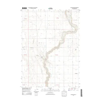
2013 Map of Balanced Rock
USGS Topo · Published 2013About this map
Salmon Falls Creek carves a deep, winding canyon through this high desert landscape, serving as the dominant physical feature of the region. The map captures the meeting point of the arid Bruneau Desert and the engineered irrigation systems that sustain local agriculture, such as the Magic Water Canal and High Line Canal. Near the southern edge of the canyon, the iconic Balanced Rock stands as a notable landmark alongside Balanced Rock Crossing.
Find a feature on this map
32 named features on this map. Tap any name to fly to it.
Don’t see what you’re looking for? This feature index may not catch every label — zoom into the map to look around manually.
Map Details
Editions of this 2013 Balanced Rock Map
This is the sole edition of this map. No revisions or reprints were ever made.
Other maps of this area

1949 · Thousand Springs
USGS Topo · 1:24,000

1951 · Thousand Springs
USGS Topo · 1:24,000

1954 · Thousand Springs
USGS Topo · 1:24,000

1955 · Twin Falls
USGS Topo · 1:250,000

1958 · Twin Falls
USGS Topo · 1:250,000

1958 · Buhl
USGS Topo · 1:24,000

1959 · Buhl
USGS Topo · 1:62,500

1959 · Crows Nest
USGS Topo · 1:62,500

1965 · Roseworth NE
USGS Topo · 1:24,000

1965 · Tuanna Butte
USGS Topo · 1:24,000