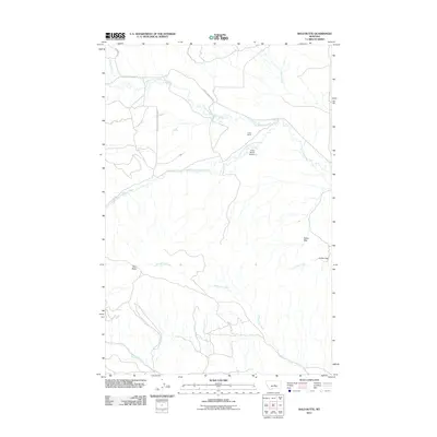
2011 Map of Bald Butte
USGS Topo · Published 2011About this map
The N Bar Ranch serves as the primary landmark in this Fergus County landscape, where the high-plains topography is defined by the convergence of several major drainages. The North Fork Flatwillow Creek and South Fork Flatwillow Creek meander across the terrain, eventually joining to form Flatwillow Creek. The ranch's local significance is noted by the inclusion of the N Bar Ranch Airport, which reflects the logistical necessities of large-scale cattle operations in central Montana.
Find a feature on this map
17 named features on this map. Tap any name to fly to it.
Don’t see what you’re looking for? This feature index may not catch every label — zoom into the map to look around manually.
Map Details
Editions of this 2011 Bald Butte Map
This is the sole edition of this map. No revisions or reprints were ever made.
Other maps of this area

1889 · Big Snowy Mountain
USGS Topo · 1:250,000

1893 · Big Snowy Mountain
USGS Topo · 1:250,000

1954 · Roundup
USGS Topo · 1:250,000

1958 · Roundup
USGS Topo · 1:250,000

1970 · Forestgrove
USGS Topo · 1:24,000

1970 · South Bench
USGS Topo · 1:24,000

1986 · Tyler
USGS Topo · 1:24,000

1986 · Devils Hole Lake
USGS Topo · 1:24,000

1986 · Pender Coulee
USGS Topo · 1:24,000
1986 · Sahara Hill
USGS Topo · 1:24,000