Old Maps of Musselshell County, Montana
Explore 339 old maps of Musselshell County, spanning from 1889 to today. These high-resolution historic maps reveal how streets, neighborhoods, landmarks, and natural features evolved over time — perfect for genealogy, metal detecting, research, and local history exploration.
What you can do with these maps:
- See how Musselshell County changed over time: Compare historical maps to modern-day views to trace roads, homesites, rail lines & more.
- View detailed metadata: Each map includes creators, publishers, year, scale, and archive source.
- Overlay maps with satellite & LiDAR: Visualize the past alongside modern tools to explore terrain & human change.
- Trusted historical sources: Maps sourced from the USGS, Library of Congress, and other archives.
- Access maps your way: View online, download high-res files, or order prints for personal or research use.
Start exploring old maps of Musselshell County to uncover forgotten places, hidden landmarks, and the deep history beneath your feet.
Musselshell County, MT maps
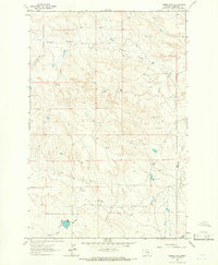
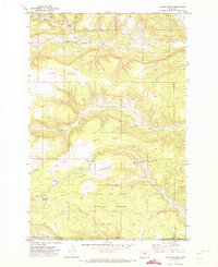
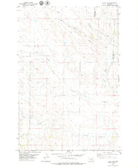
(339)- 1889 Map of Big Snowy Mountain
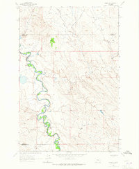
 1889 Big Snowy Mountain1889 Print · USGSCentral Montana in the late 1880s was a land of critical mountain passes and emerging frontier outposts. You can trace early settlement patterns and cattle country geography through historic sites like Ubet, Bercail, and Melville near the Musselshell River.
 - 1893 Map of Big Snowy Mountain
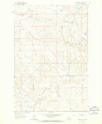
 1893 Big Snowy Mountain1893 Print · USGSCentral Montana in the late frontier era reveals a landscape shaped by the massive Big Snowy Mountain and the headwaters of major rivers. Researchers can trace early settlements and transit points like Ubet, Judith Gap, and the remote outpost of Bercail.4 unique versions available
 - 1954 Map of Forsyth, 1966 Print
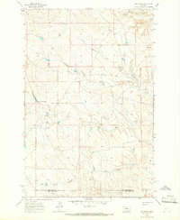
 1954 Forsyth1966 Print · USGSThe Yellowstone River valley and the northern high plains are captured here in the mid-1950s during a period of expanding energy and rail infrastructure. Genealogists and historians can trace rail sidings and cattle-country outposts like Ingomar, Vananda, and Angela.3 unique versions available
 - 1954 Map of Roundup, 1966 Print
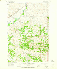
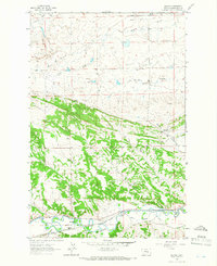
 1954 Roundup1966 Print · USGSCentral Montana in the mid-1960s showcases a landscape of high-plains agriculture and vital rail connections. Researchers can trace historic routes through Harlowton and Roundup while locating landmarks like Judith Cemetery and Deadmans Basin Reservoir.2 unique versions available
 - 1957 Map of Forsyth
 1957 Forsyth1957 Print · USGSSouth-central Montana in the late fifties is captured here through its dual-river geography and emergent energy economy. Researchers can trace the path of the Northern Pacific through Forsyth, locate the Ragged Point Oil Field, and find early sidings like Ahles Siding.
 - 1958 Map of Roundup
 1958 Roundup1958 Print · USGSCentral Montana ranching and rail infrastructure are captured here in the late fifties as the Musselshell River valley thrived. Researchers can trace the Great Northern line through Harlowton or locate the Judith Cemetery and Gage Community.2 unique versions available
 - 1958 Map of Forsyth
 1958 Forsyth1958 Print · USGSMid-century Montana comes alive along the Yellowstone River and the competing transcontinental rail lines. Local historians can trace the legacy of the Northern Pacific through Forsyth or explore early oil developments at the Ragged Point Oil Field.
 - 1962 Map of Queens Point, 1965 Print
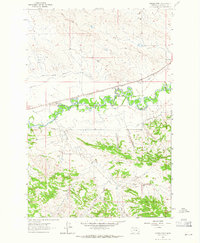 1962 Queens Point1965 Print · USGSCentral Montana’s Musselshell River valley is captured here in the early sixties, showing a landscape defined by the railroad and irrigation. Trace the path of the Chicago Milwaukee St Paul and Pacific near Melstone or find named landmarks like Queens Point.2 unique versions available
 - 1962 Map of Melstone NE, 1965 Print
 1962 Melstone NE1965 Print · USGSMusselshell River country during the early sixties shows a landscape defined by petroleum extraction and heavy rail. Researchers can trace the development of the Ivanhoe Dome Oil Field and the path of the Chicago Milwaukee St Paul and Pacific railroad.2 unique versions available
 - 1962 Map of Maxwell Ranch, 1965 Print
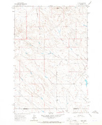
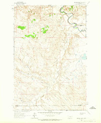 1962 Maxwell Ranch1965 Print · USGSThe high plains of Petroleum County are documented in the early sixties as cattle ranching and resource exploration defined the land. Researchers can trace the layout of the Maxwell Ranch, find early industrial marks like a Drill Hole, and follow the Musselshell River.2 unique versions available
 - 1962 Map of Melstone NW, 1965 Print
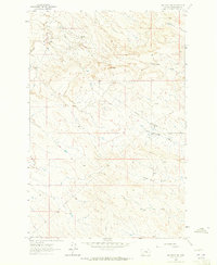 1962 Melstone NW1965 Print · USGSMusselshell County entered a period of industrial expansion in the early sixties as energy infrastructure reshaped the landscape. Trace the network of the Ragged Point Oil Field and find scattered landmarks like Seventynine Coulee and the Pumping Sta.2 unique versions available
 - 1962 Map of Mosby SE, 1965 Print
 1962 Mosby SE1965 Print · USGSThe Musselshell River country of central Montana is captured here in the early sixties, showing the river's dramatic meanders along the Rosebud County border. Genealogists and historians can trace the intricate drainages of Nineteen Coulee and Rattlesnake Creek near a prominent cross-country Pipeline.2 unique versions available
 - 1963 Map of Melstone, 1965 Print
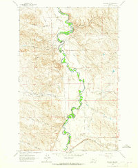
 1963 Melstone1965 Print · USGSIn the early sixties, the Musselshell River valley remained a critical corridor for the Milwaukee Road. Trace the rail infrastructure through Melstone and Bascom, alongside water features like Wilson Coulee and Twin Tops.2 unique versions available
 - 1963 Map of Kelley, 1966 Print
 1963 Kelley1966 Print · USGSCentral Montana ranching and oil country are captured here in the early 1960s along the Petroleum and Musselshell county line. Researchers can locate the Kelley (Site), trace the drainages of Mud Creek, and find early industrial markers like Oil Wells near Rattlesnake Butte.
 - 1963 Map of Musselshell, 1966 Print
 1963 Musselshell1966 Print · USGSMusselshell and the surrounding central Montana prairie are captured in the early sixties as the river-and-rail economy thrived. Genealogists can trace the settlement at Musselshell and the Goffena area, or explore the works of the Melstone Oil Field.2 unique versions available
 - 1963 Map of Akers Ranch, 1966 Print
 1963 Akers Ranch1966 Print · USGSMusselshell County ranch land is captured in the early sixties as a landscape of remote outposts and vital water sources. Researchers can locate Akers Ranch and trace the paths of North Willow Creek and Arkansas Spring.
 - 1963 Map of Musselshell NW, 1966 Print
 1963 Musselshell NW1966 Print · USGSMusselshell County in the early sixties shows a landscape of ranching and energy exploration defined by its complex coulees. Researchers can trace the development of local oil interests through Oil Wells and find named water sources like Howard Coulee and Haroldson Spring.
 - 1963 Map of Mud Spring, 1966 Print
 1963 Mud Spring1966 Print · USGSPetroleum and Musselshell counties are captured here in the early sixties, showing a landscape shaped by intermittent waterways and cattle ranching. Researchers can trace the drainage of Maginnis Creek and locate historic water sources like Mud Spring and Circle Bar Spring.
 - 1963 Map of Delphia, 1966 Print
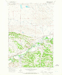
 1963 Delphia1966 Print · USGSThe Musselshell River valley in the early sixties was a corridor of rail and ranching. Trace the path of the Chicago Milwaukee St Paul and Pacific through Delphia and Melstone or locate water-works like the Goffena Ditch.
 - 1970 Map of South Bench, 1973 Print
 1970 South Bench1973 Print · USGSFergus and Golden Valley counties in the early seventies reveal a high-plains landscape where the Little Snowy Mountains meet the central Montana benches. Researchers can trace land use near Ashbridge Spring, locate a remote Cem, and explore the headwaters of North Fork Flatwillow Creek.
 - 1979 Map of Roundup
 1979 Roundup1979 Print · USGSCentral Montana at the close of the 1970s reveals a landscape defined by coal mining and major rail lines. Researchers can trace the industrial legacy of Roundup and Klein or locate landmarks like the Western Mine and Steamboat Butte.
 - 1979 Map of Bundy
 1979 Bundy1979 Print · USGSCentral Montana cattle and rail country is captured here in the late seventies as the river and railway define local life. Genealogists and historians can trace the irrigation systems of Glennie Ditch, the railroad siding at Bundy, and the rugged terrain of Painted Robe.
 - 1979 Map of Melstone
 1979 Melstone1979 Print · USGSThe ranching and rail corridors of central Montana are preserved in this late 1970s survey. Genealogists and historians can trace the Milwaukee Road through settlements like Melstone, Ingomar, and Sumatra along the Musselshell River.
 - 1979 Map of Lavina NW
 1979 Lavina NW1979 Print · USGSGolden Valley and Musselshell Counties in the late seventies show a landscape shaped by drainage and light industry. Researchers can trace the path of a major Pipeline, locate several Gravel Pits, and follow the winding courses of Currant Creek and Twin Coulee.
 - 1979 Map of Corey Flat
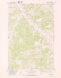 1979 Corey Flat1979 Print · USGSMusselshell County, Montana, is captured in the late seventies as a land of ranching and resource extraction. Researchers can trace land use through distinctive markers like the Musselshell Cem, the Flowing Well, and various Mines near Hawk Creek.2 unique versions available
Showing maps 1-25 of 339
Top cities of Musselshell County
Frequently asked questions
- What are the different types of historical maps available for Musselshell County?
- What is the oldest map of Musselshell County?
- Where can I purchase historical maps of Musselshell County for my home or office?
- Where can I download high-res historical maps of Musselshell County?
- Are there historical topographic maps available for Musselshell County?
- Is there historical aerial imagery available for Musselshell County?
- Where are historical maps of Musselshell County sourced from?