1960s Maps of Musselshell County, Montana
Explore 12 historic maps of Musselshell County from the 1960s. These maps offer a rare glimpse into what life looked like during the 1960s — showing old roads, neighborhoods, homes, and landmarks that have changed or disappeared over time.
Whether you're researching your family's past, planning a metal detecting trip, or studying how Musselshell County's landscape evolved across the 1960s, these high-resolution maps are a powerful tool for exploring the history of this region.
- Focus on a specific era: All maps on this page are from the 1960s, giving you a focused view of this time period.
- See what’s changed: Compare century-old streets, trails, and buildings to today's modern landscape using overlays and satellite layers.
- Research with precision: Use these maps for genealogy, historical research, land use analysis, or educational projects.
- View, download, or print: Maps are fully viewable online in high resolution, and can be downloaded or printed for your own records.
Start exploring Musselshell County's history through authentic maps from the 1960s. This is your window into the past.
Musselshell County, MT maps
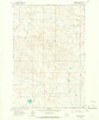
(12)- 1962 Map of Queens Point, 1965 Print
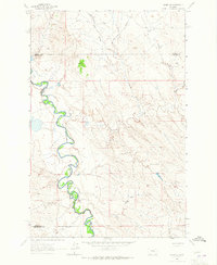
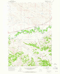 1962 Queens Point1965 Print · USGSCentral Montana’s Musselshell River valley is captured here in the early sixties, showing a landscape defined by the railroad and irrigation. Trace the path of the Chicago Milwaukee St Paul and Pacific near Melstone or find named landmarks like Queens Point.2 unique versions available
 - 1962 Map of Melstone NE, 1965 Print
 1962 Melstone NE1965 Print · USGSMusselshell River country during the early sixties shows a landscape defined by petroleum extraction and heavy rail. Researchers can trace the development of the Ivanhoe Dome Oil Field and the path of the Chicago Milwaukee St Paul and Pacific railroad.2 unique versions available
 - 1962 Map of Maxwell Ranch, 1965 Print
 1962 Maxwell Ranch1965 Print · USGSThe high plains of Petroleum County are documented in the early sixties as cattle ranching and resource exploration defined the land. Researchers can trace the layout of the Maxwell Ranch, find early industrial marks like a Drill Hole, and follow the Musselshell River.2 unique versions available
 - 1962 Map of Melstone NW, 1965 Print
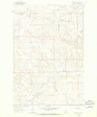
 1962 Melstone NW1965 Print · USGSMusselshell County entered a period of industrial expansion in the early sixties as energy infrastructure reshaped the landscape. Trace the network of the Ragged Point Oil Field and find scattered landmarks like Seventynine Coulee and the Pumping Sta.2 unique versions available
 - 1962 Map of Mosby SE, 1965 Print
 1962 Mosby SE1965 Print · USGSThe Musselshell River country of central Montana is captured here in the early sixties, showing the river's dramatic meanders along the Rosebud County border. Genealogists and historians can trace the intricate drainages of Nineteen Coulee and Rattlesnake Creek near a prominent cross-country Pipeline.2 unique versions available
 - 1963 Map of Melstone, 1965 Print
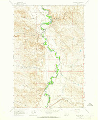
 1963 Melstone1965 Print · USGSIn the early sixties, the Musselshell River valley remained a critical corridor for the Milwaukee Road. Trace the rail infrastructure through Melstone and Bascom, alongside water features like Wilson Coulee and Twin Tops.2 unique versions available
 - 1963 Map of Kelley, 1966 Print
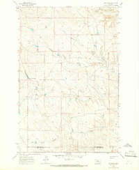
 1963 Kelley1966 Print · USGSCentral Montana ranching and oil country are captured here in the early 1960s along the Petroleum and Musselshell county line. Researchers can locate the Kelley (Site), trace the drainages of Mud Creek, and find early industrial markers like Oil Wells near Rattlesnake Butte.
 - 1963 Map of Musselshell, 1966 Print
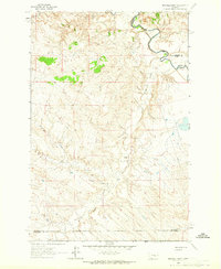
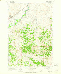
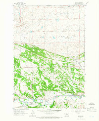
 1963 Musselshell1966 Print · USGSMusselshell and the surrounding central Montana prairie are captured in the early sixties as the river-and-rail economy thrived. Genealogists can trace the settlement at Musselshell and the Goffena area, or explore the works of the Melstone Oil Field.2 unique versions available
 - 1963 Map of Akers Ranch, 1966 Print
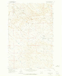
 1963 Akers Ranch1966 Print · USGSMusselshell County ranch land is captured in the early sixties as a landscape of remote outposts and vital water sources. Researchers can locate Akers Ranch and trace the paths of North Willow Creek and Arkansas Spring.
 - 1963 Map of Musselshell NW, 1966 Print
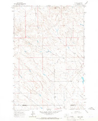
 1963 Musselshell NW1966 Print · USGSMusselshell County in the early sixties shows a landscape of ranching and energy exploration defined by its complex coulees. Researchers can trace the development of local oil interests through Oil Wells and find named water sources like Howard Coulee and Haroldson Spring.
 - 1963 Map of Mud Spring, 1966 Print
 1963 Mud Spring1966 Print · USGSPetroleum and Musselshell counties are captured here in the early sixties, showing a landscape shaped by intermittent waterways and cattle ranching. Researchers can trace the drainage of Maginnis Creek and locate historic water sources like Mud Spring and Circle Bar Spring.
 - 1963 Map of Delphia, 1966 Print
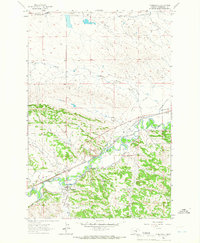
 1963 Delphia1966 Print · USGSThe Musselshell River valley in the early sixties was a corridor of rail and ranching. Trace the path of the Chicago Milwaukee St Paul and Pacific through Delphia and Melstone or locate water-works like the Goffena Ditch.
End of results
Showing maps 1-12 of 12
Top cities of Musselshell County
Frequently asked questions
- What are the different types of historical maps available for Musselshell County?
- What is the oldest map of Musselshell County?
- Where can I purchase historical maps of Musselshell County for my home or office?
- Where can I download high-res historical maps of Musselshell County?
- Are there historical topographic maps available for Musselshell County?
- Is there historical aerial imagery available for Musselshell County?
- Where are historical maps of Musselshell County sourced from?