1990s Maps of Musselshell County, Montana
Explore 4 historic maps of Musselshell County from the 1990s. These maps offer a rare glimpse into what life looked like during the 1990s — showing old roads, neighborhoods, homes, and landmarks that have changed or disappeared over time.
Whether you're researching your family's past, planning a metal detecting trip, or studying how Musselshell County's landscape evolved across the 1990s, these high-resolution maps are a powerful tool for exploring the history of this region.
- Focus on a specific era: All maps on this page are from the 1990s, giving you a focused view of this time period.
- See what’s changed: Compare century-old streets, trails, and buildings to today's modern landscape using overlays and satellite layers.
- Research with precision: Use these maps for genealogy, historical research, land use analysis, or educational projects.
- View, download, or print: Maps are fully viewable online in high resolution, and can be downloaded or printed for your own records.
Start exploring Musselshell County's history through authentic maps from the 1990s. This is your window into the past.
Musselshell County, MT maps
(4)- 1993 Map of Big Snowy Mountains
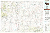
 1993 Big Snowy Mountains1993 Print · USGSCentral Montana ranching and mountain landscapes come into focus in the early 1990s as small settlements like Judith Gap and Straw dot the plains. Genealogists and historians can trace the Burlington Northern rail line and identify remote sites like Living Springs or the Elephant Rocks.
 - 1993 Map of Musselshell
 1993 Musselshell1993 Print · USGSCentral Montana's high plains and river valleys are shown in the early nineties, centered on the ranching and resource hubs of Winnett and Musselshell. Researchers can trace the Musselshell Ditch, locate the Melstone Oil Field, and explore the diverse wetlands of Lake Mason.
 - 1995 Map of Sahara Hill, 1997 Print
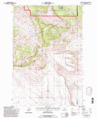 1995 Sahara Hill1997 Print · USGSGolden Valley County and the mountain front are captured here in the mid-nineties during a period of forest management revision. Researchers can trace the rugged boundaries of the Lewis and Clark National Forest and locate specific landmarks like Sahara Hill and Stonehouse Canyon.
 - 1995 Map of South Bench, 1997 Print
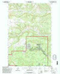 1995 South Bench1997 Print · USGSCentral Montana’s high-country drainages are captured here in the mid-1990s as the wilderness landscape transitions into ranching benches. Trace the intricate headwaters of the Little Snowy Mountains and the winding course of Willow Creek.
End of results
Showing maps 1-4 of 4
Top cities of Musselshell County
Frequently asked questions
- What are the different types of historical maps available for Musselshell County?
- What is the oldest map of Musselshell County?
- Where can I purchase historical maps of Musselshell County for my home or office?
- Where can I download high-res historical maps of Musselshell County?
- Are there historical topographic maps available for Musselshell County?
- Is there historical aerial imagery available for Musselshell County?
- Where are historical maps of Musselshell County sourced from?