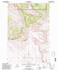
1995 Map of Sahara Hill
USGS Topo · Published 1997About this map
Little Snowy Mountains define the northern portion of this landscape, where the Lewis and Clark National Forest boundary meets the high plains of central Montana. The terrain is deeply incised by drainages like Stonehouse Canyon and the winding course of Cameron Creek, which flows southward from the mountain slopes. This 1995 revision, based on updated aerial photography, shows a remote ranching and forest environment at the border of Golden Valley and Musselshell counties. Significant landmarks such as Sahara Hill and the headwaters of Pole Creek and Minerva Creek highlight the water-dependent nature of land use in this arid region, where numerous Springs are the primary features in the high Musselshell Ranger District.
Find a feature on this map
13 named features on this map. Tap any name to fly to it.
Don’t see what you’re looking for? This feature index may not catch every label — zoom into the map to look around manually.
Map Details
Editions of this 1995 Sahara Hill Map
This is the sole edition of this map. No revisions or reprints were ever made.
Other maps of this area

1889 · Big Snowy Mountain
USGS Topo · 1:250,000

1893 · Big Snowy Mountain
USGS Topo · 1:250,000

1954 · Roundup
USGS Topo · 1:250,000

1958 · Roundup
USGS Topo · 1:250,000

1970 · South Bench
USGS Topo · 1:24,000
1970 · Alaska Bench
USGS Topo · 1:24,000

1986 · Devils Hole Lake
USGS Topo · 1:24,000

1986 · Patterson Canyon
USGS Topo · 1:24,000

1986 · Emory School
USGS Topo · 1:24,000
1986 · Sahara Hill
USGS Topo · 1:24,000