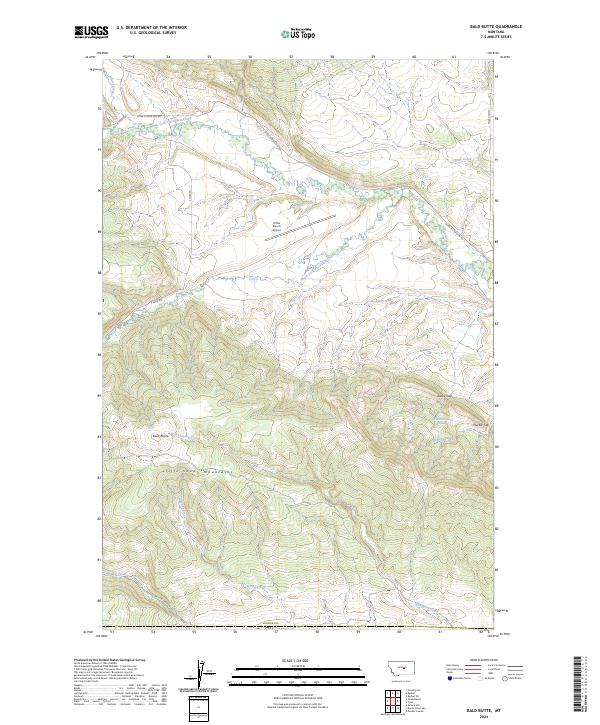
2024 Map of Bald Butte
USGS Topo · Published 2024About this map
The Little Snowy Mountains dominate the southern half of this Fergus County landscape, where the prominent peak of Bald Butte rises above the drainages of Whoop-Up Creek and Willow Creek. This high-country terrain is defined by its dramatic relief and natural passages like Daley Gap and Durfee Gap, which dictate the movement of local travel across the range. To the north, the land levels out into ranching territory along the North Fork Flatwillow Creek and South Fork Flatwillow Creek. Central to the area's modern infrastructure is the N Bar Ranch Airport, positioned near the confluence of the valley's drainage systems. The map details a network of rural access points including Upper Flatwillow RD and Tyler Cutoff, providing a clear view of the ranching corridors and watershed boundaries that characterize this part of central Montana.
Find a feature on this map
24 named features on this map. Tap any name to fly to it.
Don’t see what you’re looking for? This feature index may not catch every label — zoom into the map to look around manually.
Map Details
Editions of this 2024 Bald Butte Map
This is the sole edition of this map. No revisions or reprints were ever made.
Other maps of this area

1889 · Big Snowy Mountain
USGS Topo · 1:250,000

1893 · Big Snowy Mountain
USGS Topo · 1:250,000

1954 · Roundup
USGS Topo · 1:250,000

1958 · Roundup
USGS Topo · 1:250,000

1970 · Forestgrove
USGS Topo · 1:24,000

1970 · South Bench
USGS Topo · 1:24,000

1986 · Tyler
USGS Topo · 1:24,000

1986 · Devils Hole Lake
USGS Topo · 1:24,000

1986 · Pender Coulee
USGS Topo · 1:24,000
1986 · Sahara Hill
USGS Topo · 1:24,000