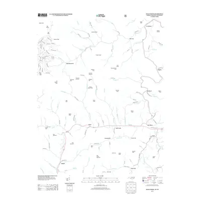
2013 Map of Bald Creek
USGS Topo · Published 2013About this map
Bee Log and the surrounding high-country settlements of Yancey County are defined by their position along the winding Cane River and its many tributaries. This 2013 survey illustrates how topography dictates human geography in the Blue Ridge, with communities like Swiss, Elk Shoal, and Bald Creek following the narrow valley floors. Long-standing local landmarks, from the heights of Bald Mountain to the curiously named Possumtrot, reflect a landscape deeply rooted in family history and Appalachian nomenclature. The map details a complex network of local routes, including Town Mountain Rd and McKinney Gap Dr, which navigate the steep gaps and ridges such as Hensley Ridge and Locust Rough Ridge. Smaller place names like Lewisburg and Bethel appear alongside numerous named branches and forks, providing a precise record of the area's rural character and hydraulic patterns as they existed in the early 21st century.
Find a feature on this map
170 named features on this map. Tap any name to fly to it.
Don’t see what you’re looking for? This feature index may not catch every label — zoom into the map to look around manually.
Map Details
Editions of this 2013 Bald Creek Map
This is the sole edition of this map. No revisions or reprints were ever made.
Other maps of this area

1891 · Roan Mountain
USGS Topo · 1:125,000

1892 · Greeneville
USGS Topo · 1:125,000

1894 · Asheville
USGS Topo · 1:125,000

1894 · Roan Mountain
USGS Topo · 1:125,000

1896 · Greeneville
USGS Topo · 1:125,000

1900 · Mount Mitchell
USGS Topo · 1:125,000

1901 · Asheville
USGS Topo · 1:125,000

1902 · Mount Mitchell
USGS Topo · 1:125,000

1904 · Roan Mountain
USGS Topo · 1:125,000

1904 · Greeneville
USGS Topo · 1:125,000