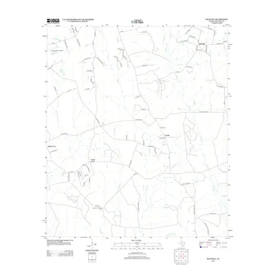
2013 Map of Bald Hill
USGS Topo · Published 2013About this map
Angelina County Airport occupies the northwestern corner of this landscape, serving as a modern anchor in a region otherwise defined by small rural settlements and a dense network of creek drainages. Small communities such as Bald Hill, Beulah, Prairie Grove, and Shady Grove are connected by a web of county roads that navigate the local hydrology. The area is heavily dissected by waterways including Biloxi Cr, Stovall Cr, and Prairie Cr, which carve through the East Texas timberlands. To the south, the Cypress Lake Lookout Tower stands as a notable landmark overlooking the bottomlands near Sandy Br and Rockfounder Br. The distribution of family-named roads like Boots Havard Rd and Ben Weeks Rd reflects a long-standing pattern of local land ownership and lineage in Angelina County.
Find a feature on this map
78 named features on this map. Tap any name to fly to it.
Don’t see what you’re looking for? This feature index may not catch every label — zoom into the map to look around manually.
Map Details
Editions of this 2013 Bald Hill Map
This is the sole edition of this map. No revisions or reprints were ever made.
Other maps of this area

1927 · Lufkin 4-c
USGS Topo · 1:24,000

1928 · Lufkin 4-d
USGS Topo · 1:24,000

1932 · Manning
USGS Topo · 1:62,500

1949 · Lufkin
USGS Topo · 1:62,500

1949 · Lufkin
USGS Topo · 1:24,000

1949 · Huntington
USGS Topo · 1:24,000

1949 · Keltys
USGS Topo · 1:24,000

1950 · Keltys
USGS Topo · 1:24,000

1950 · Lufkin
USGS Topo · 1:24,000

1950 · Huntington
USGS Topo · 1:24,000