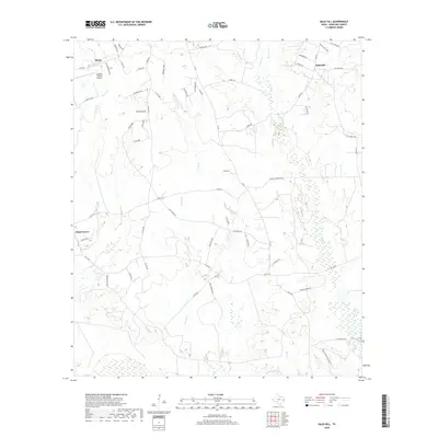
2019 Map of Bald Hill
USGS Topo · Published 2019About this map
Burke and the neighboring settlement of Bald Hill anchor this rural landscape in Angelina County, where a network of county roads and farm-to-market routes connects small communities and sprawling timberland. The topography is defined by the complex drainage systems of Stovall Cr and Prairie Cr, which move through low-lying wetlands. The presence of the Angelina County Airport in the northwest corner near Burke indicates a shift toward modern infrastructure amidst a landscape traditionally dominated by agriculture and local ranching. Family-named corridors such as Joe Freeman Ln, Boots Havard Rd, and Virgil Havard Rd provide valuable points of interest for genealogists, marking the heritage of local landholders. To the west, the community of Shady Grove sits along the upper reaches of the creek systems, while eastern drainages like Biloxi Cr and Rockfounder Br carve through the wooded terrain.
Find a feature on this map
62 named features on this map. Tap any name to fly to it.
Don’t see what you’re looking for? This feature index may not catch every label — zoom into the map to look around manually.
Map Details
Editions of this 2019 Bald Hill Map
This is the sole edition of this map. No revisions or reprints were ever made.
Other maps of this area

1927 · Lufkin 4-c
USGS Topo · 1:24,000

1928 · Lufkin 4-d
USGS Topo · 1:24,000

1932 · Manning
USGS Topo · 1:62,500

1949 · Lufkin
USGS Topo · 1:62,500

1949 · Lufkin
USGS Topo · 1:24,000

1949 · Huntington
USGS Topo · 1:24,000

1949 · Keltys
USGS Topo · 1:24,000

1950 · Keltys
USGS Topo · 1:24,000

1950 · Lufkin
USGS Topo · 1:24,000

1950 · Huntington
USGS Topo · 1:24,000