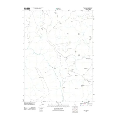
2012 Map of Bald Hills
USGS Topo · Published 2012About this map
Redwood Cr and its tributaries carve a network of steep drainages through this portion of Humboldt County, defining a landscape where high ridges and open grasslands dictate human settlement. The territory is characterized by numerous prairies, such as Pitt Place Prairie and Childs Hill Prairie, which have historically supported ranching operations. The presence of the Graham and McCombs Ranch, Anton Lyons Ranch, and Tomlinson Brothers Ranch indicates a land-use pattern centered on livestock and remote homesteads connected by a sparse road network.
Find a feature on this map
44 named features on this map. Tap any name to fly to it.
Don’t see what you’re looking for? This feature index may not catch every label — zoom into the map to look around manually.
Map Details
Editions of this 2012 Bald Hills Map
This is the sole edition of this map. No revisions or reprints were ever made.
Other maps of this area

1925 · Hoopa
USGS Topo · 1:125,000

1945 · Orick
USGS Topo · 1:62,500

1945 · Trinidad
USGS Topo · 1:62,500

1945 · Coyote Peak
USGS Topo · 1:62,500

1945 · Tectah Creek
USGS Topo · 1:62,500

1948 · Weed
USGS Topo · 1:250,000

1949 · Eureka
USGS Topo · 1:250,000

1950 · Weed
USGS Topo · 1:250,000
1952 · Orick
USGS Topo · 1:62,500

1952 · Coyote Peak
USGS Topo · 1:62,500