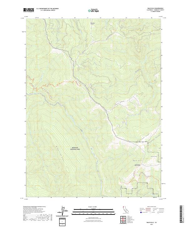
2021 Map of Bald Hills
USGS Topo · Published 2021About this map
Redwood National Park dominates this section of Humboldt County, preserving a landscape defined by the steep drainage of Redwood Creek and its high flanking ridges. The northern reaches of the Bald Hills are visible here, characterized by open grasslands such as Pitt Place Prairie that contrast with the timbered slopes of Bridge Creek Ridge. The topographic detail traces an extensive network of trails, including the Tall Trees Trl and the Emerald Ridge Trl, which navigate the elevation drops from Eagle Ridge toward the creek bed. Local history and ranching legacies are anchored by features like Lyons Ranch Trl and the Hancock Ranch Rd, while landmarks like Schoolhouse Peak and Schoolhouse Pasture Rock mark the southern interior highlands. This survey documents the intersection of modern recreational access and older agricultural footprints in the Pacific Northwest timberlands.
Find a feature on this map
31 named features on this map. Tap any name to fly to it.
Don’t see what you’re looking for? This feature index may not catch every label — zoom into the map to look around manually.
Map Details
Editions of this 2021 Bald Hills Map
This is the sole edition of this map. No revisions or reprints were ever made.
Other maps of this area

1925 · Hoopa
USGS Topo · 1:125,000

1945 · Orick
USGS Topo · 1:62,500

1945 · Trinidad
USGS Topo · 1:62,500

1945 · Coyote Peak
USGS Topo · 1:62,500

1945 · Tectah Creek
USGS Topo · 1:62,500

1948 · Weed
USGS Topo · 1:250,000

1949 · Eureka
USGS Topo · 1:250,000

1950 · Weed
USGS Topo · 1:250,000
1952 · Orick
USGS Topo · 1:62,500

1952 · Coyote Peak
USGS Topo · 1:62,500